
Y22A Socorro, NM, USA - Earthquake Result Viewer
| ||||||||||||||||||
| ||||||||||||||||||
| ||||||||||||||||||
|
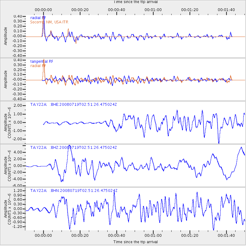
Signal To Noise
| Channel | StoN | STA | LTA |
| TA:Y22A: :BHZ:20080719T02:51:26.475024Z | 4.027764 | 3.46437E-7 | 8.601224E-8 |
| TA:Y22A: :BHN:20080719T02:51:26.475024Z | 1.7971481 | 1.2604143E-7 | 7.0134135E-8 |
| TA:Y22A: :BHE:20080719T02:51:26.475024Z | 1.1991417 | 1.1023959E-7 | 9.193207E-8 |
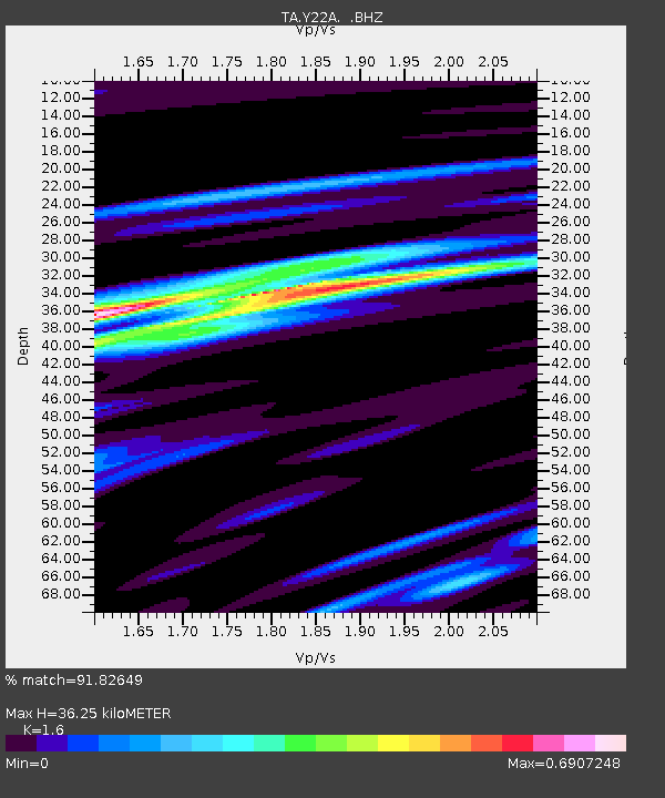
| Arrivals | |
| Ps | 3.4 SECOND |
| PpPs | 14 SECOND |
| PsPs/PpSs | 18 SECOND |

