Y22A Socorro, NM, USA - Earthquake Result Viewer
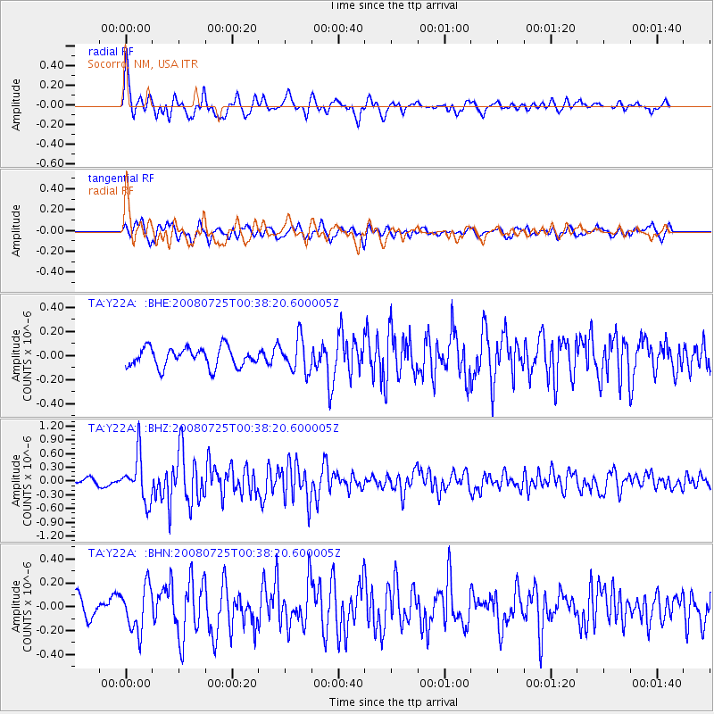
Earthquake location: Rat Islands, Aleutian Islands
Earthquake latitude/longitude: 51.3/179.0
Earthquake time(UTC): 2008/07/25 (207) 00:29:22 GMT
Earthquake Depth: 21 km
Earthquake Magnitude: 5.7 MB, 5.5 MS, 5.9 MW, 5.9 MW
Earthquake Catalog/Contributor: WHDF/NEIC
Network: TA USArray Transportable Network (new EarthScope stations)
Station: Y22A Socorro, NM, USA
Lat/Lon: 33.94 N/106.97 W
Elevation: 1674 m
Distance: 54.8 deg
Az: 77.906 deg
Baz: 312.379 deg
Ray Param: 0.06516459
Estimated Moho Depth: 54.75 km
Estimated Crust Vp/Vs: 2.06
Assumed Crust Vp: 6.502 km/s
Estimated Crust Vs: 3.152 km/s
Estimated Crust Poisson's Ratio: 0.35
Radial Match: 82.45009 %
Radial Bump: 400
Transverse Match: 68.47224 %
Transverse Bump: 400
SOD ConfigId: 2504
Insert Time: 2010-03-06 17:00:55.196 +0000
GWidth: 2.5
Max Bumps: 400
Tol: 0.001

Signal To Noise

ChannelStoNSTALTA
TA:Y22A: :BHZ:20080725T00:38:20.600005Z6.8830994.9719415E-77.223406E-8
TA:Y22A: :BHN:20080725T00:38:20.600005Z2.05009751.887678E-79.207747E-8
TA:Y22A: :BHE:20080725T00:38:20.600005Z1.71254471.366943E-77.981941E-8
Arrivals
Ps9.4 SECOND
PpPs25 SECOND
PsPs/PpSs34 SECOND