You are here: Home > Network List > US - United States National Seismic Network Stations List
> Station DGMT Dagmar, Montana, USA > Earthquake Result Viewer
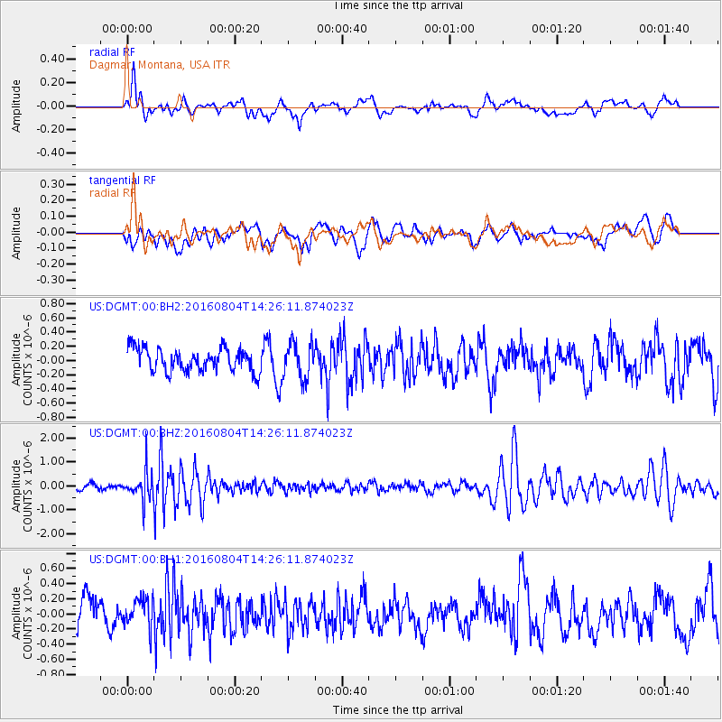
DGMT Dagmar, Montana, USA - Earthquake Result Viewer
*The percent match for this event was below the threshold and hence no stack was calculated.
| Earthquake location: |
Jujuy Province, Argentina |
| Earthquake latitude/longitude: |
-22.4/-66.0 |
| Earthquake time(UTC): |
2016/08/04 (217) 14:15:11 GMT |
| Earthquake Depth: |
258 km |
| Earthquake Magnitude: |
6.0 MO |
| Earthquake Catalog/Contributor: |
NEIC PDE/NEIC ALERT |
|
| Network: |
US United States National Seismic Network |
| Station: |
DGMT Dagmar, Montana, USA |
| Lat/Lon: |
48.47 N/104.20 W |
| Elevation: |
0.0 m |
|
| Distance: |
78.4 deg |
| Az: |
335.154 deg |
| Baz: |
144.243 deg |
| Ray Param: |
$rayparam |
*The percent match for this event was below the threshold and hence was not used in the summary stack. |
|
| Radial Match: |
59.63971 % |
| Radial Bump: |
400 |
| Transverse Match: |
38.441654 % |
| Transverse Bump: |
400 |
| SOD ConfigId: |
1634031 |
| Insert Time: |
2016-08-18 14:19:31.242 +0000 |
| GWidth: |
2.5 |
| Max Bumps: |
400 |
| Tol: |
0.001 |
|
Signal To Noise
| Channel | StoN | STA | LTA |
| US:DGMT:00:BHZ:20160804T14:26:11.874023Z | 5.758428 | 5.9081435E-7 | 1.02599934E-7 |
| US:DGMT:00:BH1:20160804T14:26:11.874023Z | 0.9612614 | 2.0585023E-7 | 2.1414593E-7 |
| US:DGMT:00:BH2:20160804T14:26:11.874023Z | 1.572079 | 2.5338463E-7 | 1.6117805E-7 |
| Arrivals |
| Ps | |
| PpPs | |
| PsPs/PpSs | |


