You are here: Home > Network List > US - United States National Seismic Network Stations List
> Station EGMT Eagleton, Montana, USA > Earthquake Result Viewer
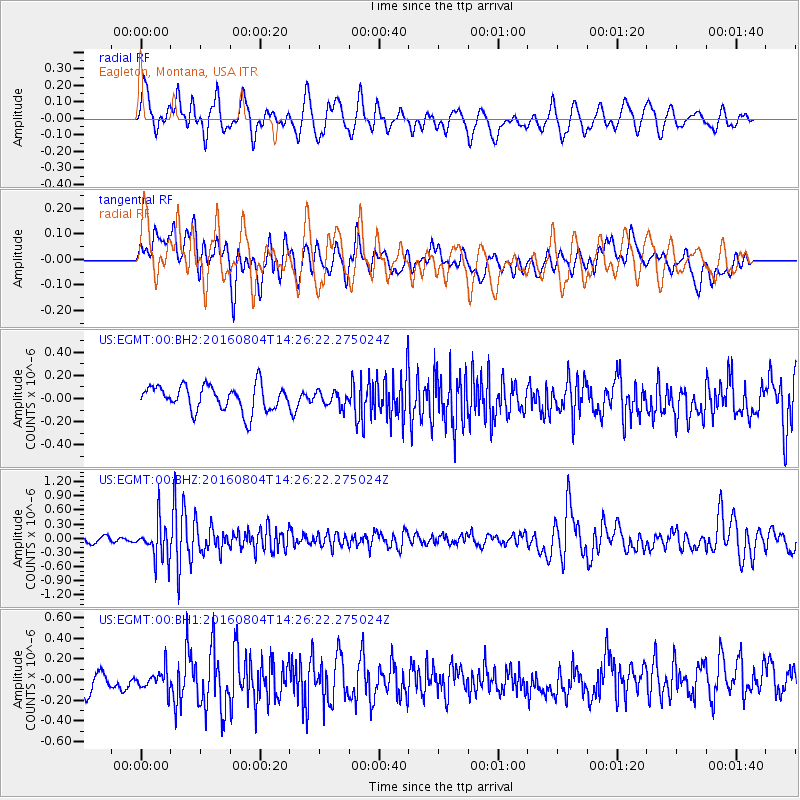
EGMT Eagleton, Montana, USA - Earthquake Result Viewer
*The percent match for this event was below the threshold and hence no stack was calculated.
| Earthquake location: |
Jujuy Province, Argentina |
| Earthquake latitude/longitude: |
-22.4/-66.0 |
| Earthquake time(UTC): |
2016/08/04 (217) 14:15:11 GMT |
| Earthquake Depth: |
258 km |
| Earthquake Magnitude: |
6.0 MO |
| Earthquake Catalog/Contributor: |
NEIC PDE/NEIC ALERT |
|
| Network: |
US United States National Seismic Network |
| Station: |
EGMT Eagleton, Montana, USA |
| Lat/Lon: |
48.02 N/109.75 W |
| Elevation: |
1055 m |
|
| Distance: |
80.3 deg |
| Az: |
331.901 deg |
| Baz: |
139.505 deg |
| Ray Param: |
$rayparam |
*The percent match for this event was below the threshold and hence was not used in the summary stack. |
|
| Radial Match: |
60.41431 % |
| Radial Bump: |
400 |
| Transverse Match: |
53.17817 % |
| Transverse Bump: |
400 |
| SOD ConfigId: |
1634031 |
| Insert Time: |
2016-08-18 14:19:36.925 +0000 |
| GWidth: |
2.5 |
| Max Bumps: |
400 |
| Tol: |
0.001 |
|
Signal To Noise
| Channel | StoN | STA | LTA |
| US:EGMT:00:BHZ:20160804T14:26:22.275024Z | 5.553303 | 3.9772007E-7 | 7.161865E-8 |
| US:EGMT:00:BH1:20160804T14:26:22.275024Z | 0.99285823 | 1.0792406E-7 | 1.0870037E-7 |
| US:EGMT:00:BH2:20160804T14:26:22.275024Z | 0.5666426 | 6.258003E-8 | 1.1044004E-7 |
| Arrivals |
| Ps | |
| PpPs | |
| PsPs/PpSs | |


