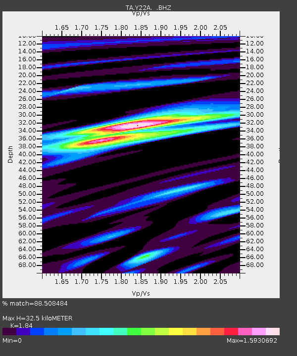
Y22A Socorro, NM, USA - Earthquake Result Viewer
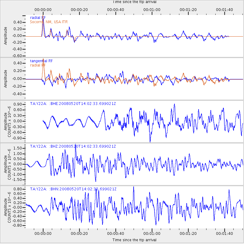
Earthquake location: Rat Islands, Aleutian Islands
Earthquake latitude/longitude: 51.2/178.8
Earthquake time(UTC): 2008/05/20 (141) 13:53:35 GMT
Earthquake Depth: 27 km
Earthquake Magnitude: 5.8 MB, 6.0 MS, 6.3 MW, 6.3 MW
Earthquake Catalog/Contributor: WHDF/NEIC
Network: TA USArray Transportable Network (new EarthScope stations)
Station: Y22A Socorro, NM, USA
Lat/Lon: 33.94 N/106.97 W
Elevation: 1674 m
Distance: 55.0 deg
Az: 77.673 deg
Baz: 312.275 deg
Ray Param: 0.06503951
Estimated Moho Depth: 32.5 km
Estimated Crust Vp/Vs: 1.84
Assumed Crust Vp: 6.502 km/s
Estimated Crust Vs: 3.533 km/s
Estimated Crust Poisson's Ratio: 0.29
Radial Match: 88.508484 %
Radial Bump: 400
Transverse Match: 72.96023 %
Transverse Bump: 400
SOD ConfigId: 2504
Insert Time: 2010-03-06 17:01:48.210 +0000
GWidth: 2.5
Max Bumps: 400
Tol: 0.001

Signal To Noise

ChannelStoNSTALTA
TA:Y22A: :BHZ:20080520T14:02:33.699021Z4.64586164.9557957E-71.0667119E-7
TA:Y22A: :BHN:20080520T14:02:33.699021Z2.28920651.9995684E-78.734767E-8
TA:Y22A: :BHE:20080520T14:02:33.699021Z2.08884553.3143937E-71.5867107E-7
Arrivals
Ps4.4 SECOND
PpPs13 SECOND
PsPs/PpSs18 SECOND