You are here: Home > Network List > TA - USArray Transportable Network (new EarthScope stations) Stations List
> Station Y22A Socorro, NM, USA > Earthquake Result Viewer
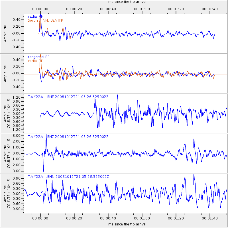
Y22A Socorro, NM, USA - Earthquake Result Viewer
*The percent match for this event was below the threshold and hence no stack was calculated.
| Earthquake location: |
Southern Bolivia |
| Earthquake latitude/longitude: |
-20.1/-65.0 |
| Earthquake time(UTC): |
2008/10/12 (286) 20:55:41 GMT |
| Earthquake Depth: |
353 km |
| Earthquake Magnitude: |
6.0 MB, 6.2 MW, 6.2 MW |
| Earthquake Catalog/Contributor: |
WHDF/NEIC |
|
| Network: |
TA USArray Transportable Network (new EarthScope stations) |
| Station: |
Y22A Socorro, NM, USA |
| Lat/Lon: |
33.94 N/106.97 W |
| Elevation: |
1674 m |
|
| Distance: |
67.0 deg |
| Az: |
322.826 deg |
| Baz: |
136.925 deg |
| Ray Param: |
$rayparam |
*The percent match for this event was below the threshold and hence was not used in the summary stack. |
|
| Radial Match: |
75.995476 % |
| Radial Bump: |
400 |
| Transverse Match: |
66.22761 % |
| Transverse Bump: |
400 |
| SOD ConfigId: |
2556 |
| Insert Time: |
2010-03-06 17:02:17.230 +0000 |
| GWidth: |
2.5 |
| Max Bumps: |
400 |
| Tol: |
0.001 |
|
Signal To Noise
| Channel | StoN | STA | LTA |
| TA:Y22A: :BHZ:20081012T21:05:26.525002Z | 10.202716 | 1.153158E-6 | 1.1302461E-7 |
| TA:Y22A: :BHN:20081012T21:05:26.525002Z | 1.4223821 | 2.8176342E-7 | 1.9809264E-7 |
| TA:Y22A: :BHE:20081012T21:05:26.525002Z | 4.81546 | 5.361701E-7 | 1.1134348E-7 |
| Arrivals |
| Ps | |
| PpPs | |
| PsPs/PpSs | |


