You are here: Home > Network List > TA - USArray Transportable Network (new EarthScope stations) Stations List
> Station Y22A Socorro, NM, USA > Earthquake Result Viewer
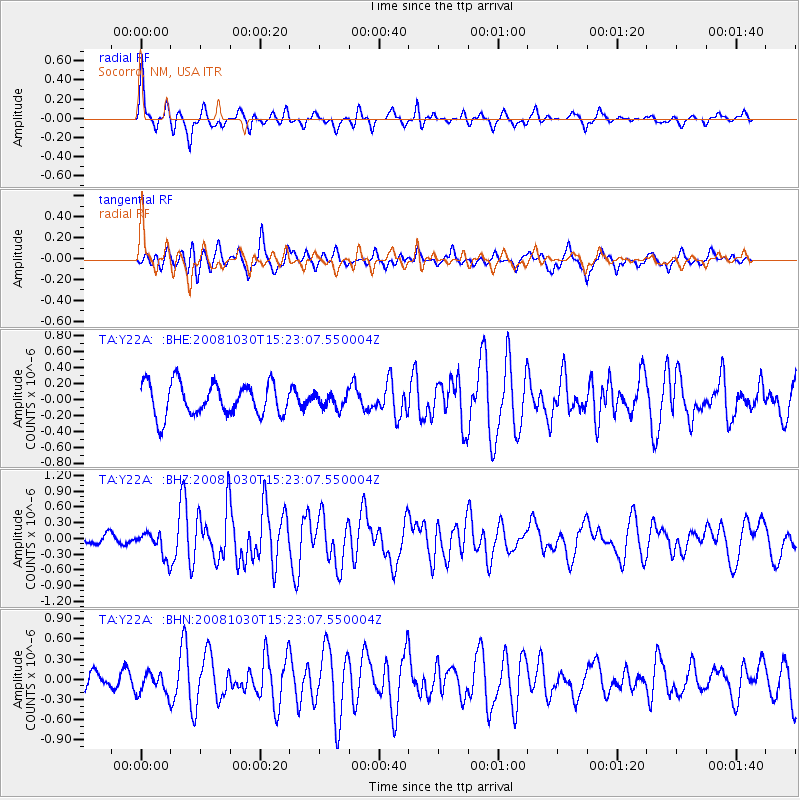
Y22A Socorro, NM, USA - Earthquake Result Viewer
*The percent match for this event was below the threshold and hence no stack was calculated.
| Earthquake location: |
Central East Pacific Rise |
| Earthquake latitude/longitude: |
-9.0/-108.2 |
| Earthquake time(UTC): |
2008/10/30 (304) 15:15:41 GMT |
| Earthquake Depth: |
10 km |
| Earthquake Magnitude: |
5.5 MB, 5.8 MS, 6.0 MW, 6.0 MW |
| Earthquake Catalog/Contributor: |
WHDF/NEIC |
|
| Network: |
TA USArray Transportable Network (new EarthScope stations) |
| Station: |
Y22A Socorro, NM, USA |
| Lat/Lon: |
33.94 N/106.97 W |
| Elevation: |
1674 m |
|
| Distance: |
42.7 deg |
| Az: |
1.569 deg |
| Baz: |
181.864 deg |
| Ray Param: |
$rayparam |
*The percent match for this event was below the threshold and hence was not used in the summary stack. |
|
| Radial Match: |
77.22778 % |
| Radial Bump: |
395 |
| Transverse Match: |
57.31848 % |
| Transverse Bump: |
400 |
| SOD ConfigId: |
2560 |
| Insert Time: |
2010-03-06 17:02:22.456 +0000 |
| GWidth: |
2.5 |
| Max Bumps: |
400 |
| Tol: |
0.001 |
|
Signal To Noise
| Channel | StoN | STA | LTA |
| TA:Y22A: :BHZ:20081030T15:23:07.550004Z | 2.2817543 | 2.4043865E-7 | 1.05374475E-7 |
| TA:Y22A: :BHN:20081030T15:23:07.550004Z | 1.2710912 | 1.6245284E-7 | 1.2780579E-7 |
| TA:Y22A: :BHE:20081030T15:23:07.550004Z | 0.4437434 | 8.882206E-8 | 2.0016537E-7 |
| Arrivals |
| Ps | |
| PpPs | |
| PsPs/PpSs | |


