You are here: Home > Network List > TA - USArray Transportable Network (new EarthScope stations) Stations List
> Station Y22A Socorro, NM, USA > Earthquake Result Viewer
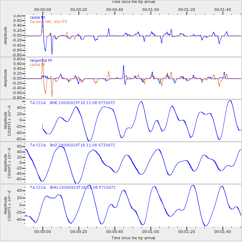
Y22A Socorro, NM, USA - Earthquake Result Viewer
*The percent match for this event was below the threshold and hence no stack was calculated.
| Earthquake location: |
Samoa Islands Region |
| Earthquake latitude/longitude: |
-15.9/-171.7 |
| Earthquake time(UTC): |
2009/09/29 (272) 18:19:35 GMT |
| Earthquake Depth: |
10 km |
| Earthquake Magnitude: |
5.6 MB |
| Earthquake Catalog/Contributor: |
WHDF/NEIC |
|
| Network: |
TA USArray Transportable Network (new EarthScope stations) |
| Station: |
Y22A Socorro, NM, USA |
| Lat/Lon: |
33.94 N/106.97 W |
| Elevation: |
1674 m |
|
| Distance: |
79.0 deg |
| Az: |
49.959 deg |
| Baz: |
242.362 deg |
| Ray Param: |
$rayparam |
*The percent match for this event was below the threshold and hence was not used in the summary stack. |
|
| Radial Match: |
78.06411 % |
| Radial Bump: |
400 |
| Transverse Match: |
73.37754 % |
| Transverse Bump: |
234 |
| SOD ConfigId: |
2622 |
| Insert Time: |
2010-03-06 17:02:36.145 +0000 |
| GWidth: |
2.5 |
| Max Bumps: |
400 |
| Tol: |
0.001 |
|
Signal To Noise
| Channel | StoN | STA | LTA |
| TA:Y22A: :BHZ:20090929T18:31:08.673997Z | 1.3388224 | 5.065553E-5 | 3.783588E-5 |
| TA:Y22A: :BHN:20090929T18:31:08.673997Z | 0.77548563 | 2.097823E-5 | 2.7051734E-5 |
| TA:Y22A: :BHE:20090929T18:31:08.673997Z | 1.3146687 | 3.5380017E-5 | 2.6911739E-5 |
| Arrivals |
| Ps | |
| PpPs | |
| PsPs/PpSs | |


