You are here: Home > Network List > TA - USArray Transportable Network (new EarthScope stations) Stations List
> Station Y22A Socorro, NM, USA > Earthquake Result Viewer
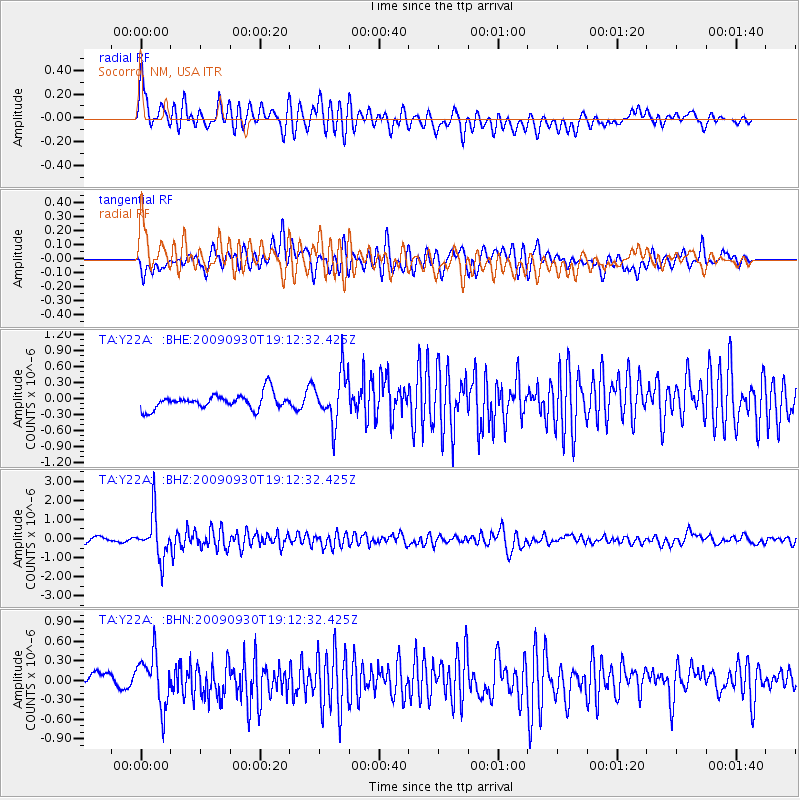
Y22A Socorro, NM, USA - Earthquake Result Viewer
*The percent match for this event was below the threshold and hence no stack was calculated.
| Earthquake location: |
Peru-Bolivia Border Region |
| Earthquake latitude/longitude: |
-15.6/-69.3 |
| Earthquake time(UTC): |
2009/09/30 (273) 19:03:17 GMT |
| Earthquake Depth: |
255 km |
| Earthquake Magnitude: |
5.9 MB, 5.8 MW |
| Earthquake Catalog/Contributor: |
WHDF/NEIC |
|
| Network: |
TA USArray Transportable Network (new EarthScope stations) |
| Station: |
Y22A Socorro, NM, USA |
| Lat/Lon: |
33.94 N/106.97 W |
| Elevation: |
1674 m |
|
| Distance: |
60.9 deg |
| Az: |
324.447 deg |
| Baz: |
137.616 deg |
| Ray Param: |
$rayparam |
*The percent match for this event was below the threshold and hence was not used in the summary stack. |
|
| Radial Match: |
76.4337 % |
| Radial Bump: |
400 |
| Transverse Match: |
67.15343 % |
| Transverse Bump: |
400 |
| SOD ConfigId: |
2622 |
| Insert Time: |
2010-03-06 17:02:37.431 +0000 |
| GWidth: |
2.5 |
| Max Bumps: |
400 |
| Tol: |
0.001 |
|
Signal To Noise
| Channel | StoN | STA | LTA |
| TA:Y22A: :BHZ:20090930T19:12:32.425Z | 8.595397 | 1.158031E-6 | 1.3472686E-7 |
| TA:Y22A: :BHN:20090930T19:12:32.425Z | 4.6404476 | 3.881109E-7 | 8.3636515E-8 |
| TA:Y22A: :BHE:20090930T19:12:32.425Z | 3.2284822 | 4.6817917E-7 | 1.4501525E-7 |
| Arrivals |
| Ps | |
| PpPs | |
| PsPs/PpSs | |


