You are here: Home > Network List > LD - Lamont-Doherty Cooperative Seismographic Network Stations List
> Station GEDE Greenville, DE, USA > Earthquake Result Viewer
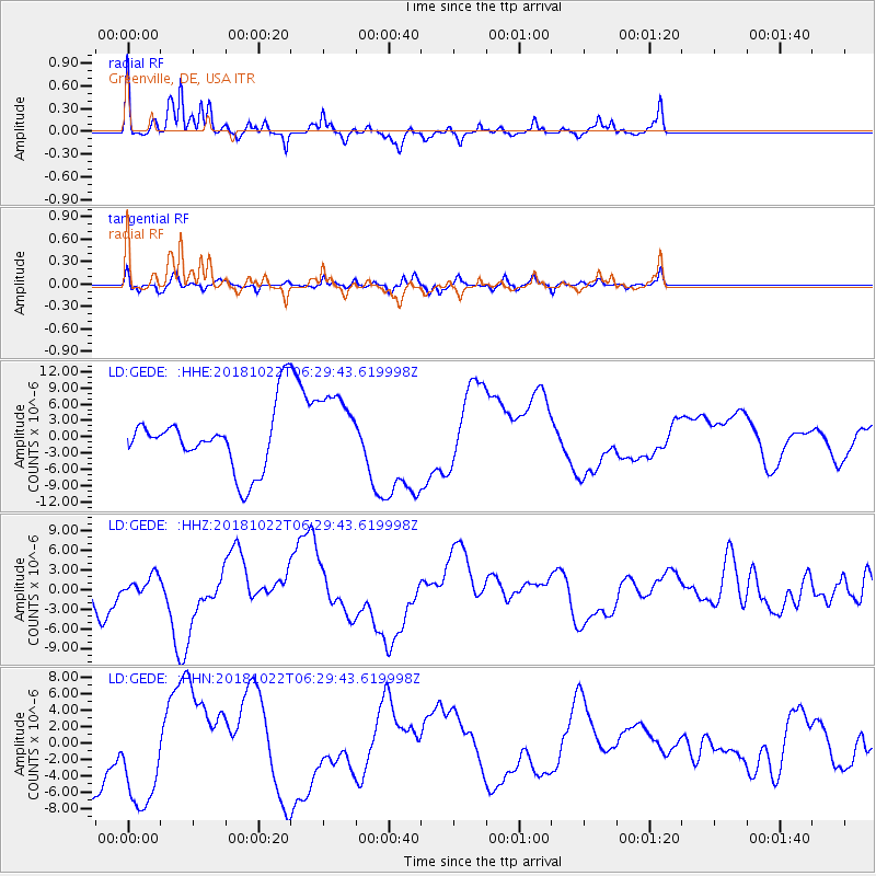
GEDE Greenville, DE, USA - Earthquake Result Viewer
*The percent match for this event was below the threshold and hence no stack was calculated.
| Earthquake location: |
Vancouver Island, Canada Region |
| Earthquake latitude/longitude: |
49.3/-129.7 |
| Earthquake time(UTC): |
2018/10/22 (295) 06:22:48 GMT |
| Earthquake Depth: |
10 km |
| Earthquake Magnitude: |
6.5 Mww |
| Earthquake Catalog/Contributor: |
NEIC PDE/us |
|
| Network: |
LD Lamont-Doherty Cooperative Seismographic Network |
| Station: |
GEDE Greenville, DE, USA |
| Lat/Lon: |
39.81 N/75.64 W |
| Elevation: |
105 m |
|
| Distance: |
38.9 deg |
| Az: |
83.113 deg |
| Baz: |
302.491 deg |
| Ray Param: |
$rayparam |
*The percent match for this event was below the threshold and hence was not used in the summary stack. |
|
| Radial Match: |
55.03519 % |
| Radial Bump: |
259 |
| Transverse Match: |
45.237015 % |
| Transverse Bump: |
317 |
| SOD ConfigId: |
13570011 |
| Insert Time: |
2019-05-01 14:17:14.478 +0000 |
| GWidth: |
2.5 |
| Max Bumps: |
400 |
| Tol: |
0.001 |
|
Signal To Noise
| Channel | StoN | STA | LTA |
| LD:GEDE: :HHZ:20181022T06:29:43.619998Z | 0.3938445 | 1.1953211E-6 | 3.0350077E-6 |
| LD:GEDE: :HHN:20181022T06:29:43.619998Z | 2.064127 | 6.382328E-6 | 3.092023E-6 |
| LD:GEDE: :HHE:20181022T06:29:43.619998Z | 1.3111242 | 7.3026736E-6 | 5.56978E-6 |
| Arrivals |
| Ps | |
| PpPs | |
| PsPs/PpSs | |


