You are here: Home > Network List > TA - USArray Transportable Network (new EarthScope stations) Stations List
> Station Y22A Socorro, NM, USA > Earthquake Result Viewer
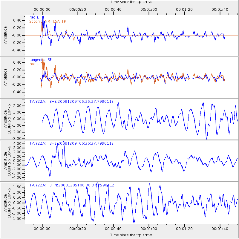
Y22A Socorro, NM, USA - Earthquake Result Viewer
*The percent match for this event was below the threshold and hence no stack was calculated.
| Earthquake location: |
Kermadec Islands Region |
| Earthquake latitude/longitude: |
-31.2/-176.9 |
| Earthquake time(UTC): |
2008/12/09 (344) 06:23:59 GMT |
| Earthquake Depth: |
18 km |
| Earthquake Magnitude: |
6.2 MB, 6.7 MS, 6.8 MW, 6.7 MW |
| Earthquake Catalog/Contributor: |
WHDF/NEIC |
|
| Network: |
TA USArray Transportable Network (new EarthScope stations) |
| Station: |
Y22A Socorro, NM, USA |
| Lat/Lon: |
33.94 N/106.97 W |
| Elevation: |
1674 m |
|
| Distance: |
92.4 deg |
| Az: |
51.421 deg |
| Baz: |
233.656 deg |
| Ray Param: |
$rayparam |
*The percent match for this event was below the threshold and hence was not used in the summary stack. |
|
| Radial Match: |
74.18715 % |
| Radial Bump: |
400 |
| Transverse Match: |
48.340466 % |
| Transverse Bump: |
400 |
| SOD ConfigId: |
2658 |
| Insert Time: |
2010-03-06 17:02:56.432 +0000 |
| GWidth: |
2.5 |
| Max Bumps: |
400 |
| Tol: |
0.001 |
|
Signal To Noise
| Channel | StoN | STA | LTA |
| TA:Y22A: :BHZ:20081209T06:36:37.799011Z | 3.4714088 | 1.7216375E-6 | 4.959478E-7 |
| TA:Y22A: :BHN:20081209T06:36:37.799011Z | 1.4700634 | 7.839265E-7 | 5.3326033E-7 |
| TA:Y22A: :BHE:20081209T06:36:37.799011Z | 1.4355823 | 1.4401264E-6 | 1.0031654E-6 |
| Arrivals |
| Ps | |
| PpPs | |
| PsPs/PpSs | |


