You are here: Home > Network List > CN - Canadian National Seismograph Network Stations List
> Station INK INUVIK, NT > Earthquake Result Viewer
INK INUVIK, NT - Earthquake Result Viewer
*The percent match for this event was below the threshold and hence no stack was calculated.
| Earthquake location: |
Taiwan Region |
| Earthquake latitude/longitude: |
24.1/122.6 |
| Earthquake time(UTC): |
2018/10/23 (296) 04:34:58 GMT |
| Earthquake Depth: |
34 km |
| Earthquake Magnitude: |
5.7 Mww |
| Earthquake Catalog/Contributor: |
NEIC PDE/us |
|
| Network: |
CN Canadian National Seismograph Network |
| Station: |
INK INUVIK, NT |
| Lat/Lon: |
68.31 N/133.53 W |
| Elevation: |
44 m |
|
| Distance: |
72.8 deg |
| Az: |
22.199 deg |
| Baz: |
291.758 deg |
| Ray Param: |
$rayparam |
*The percent match for this event was below the threshold and hence was not used in the summary stack. |
|
| Radial Match: |
68.83362 % |
| Radial Bump: |
400 |
| Transverse Match: |
42.90494 % |
| Transverse Bump: |
348 |
| SOD ConfigId: |
13570011 |
| Insert Time: |
2019-05-01 14:23:21.202 +0000 |
| GWidth: |
2.5 |
| Max Bumps: |
400 |
| Tol: |
0.001 |
|
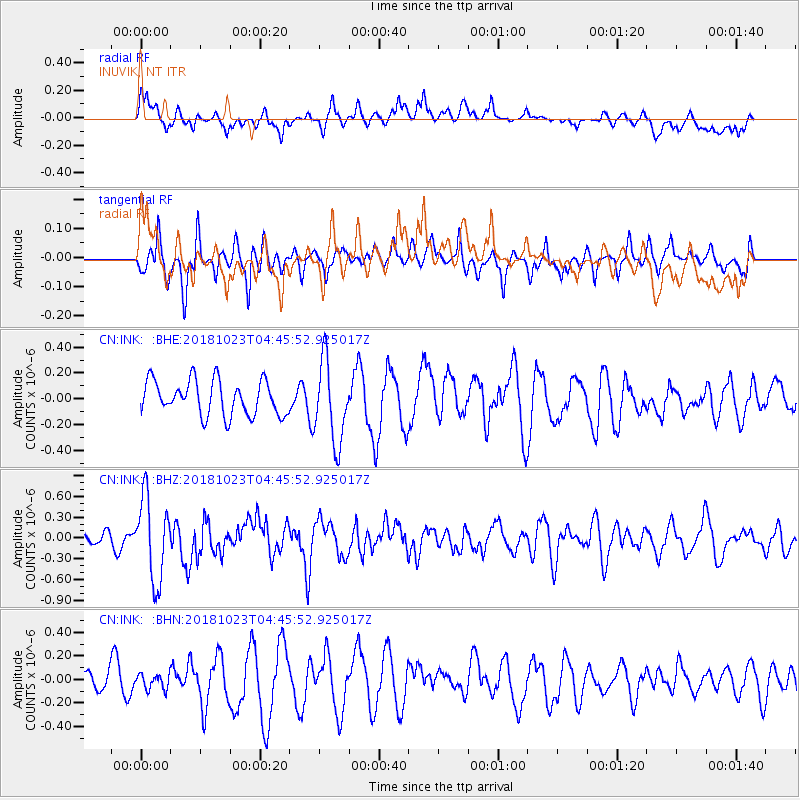
Signal To Noise
| Channel | StoN | STA | LTA |
| CN:INK: :BHZ:20181023T04:45:52.925017Z | 3.3226144 | 5.97527E-7 | 1.7983639E-7 |
| CN:INK: :BHN:20181023T04:45:52.925017Z | 0.5555127 | 6.298623E-8 | 1.1338396E-7 |
| CN:INK: :BHE:20181023T04:45:52.925017Z | 2.3568072 | 3.1649975E-7 | 1.3429174E-7 |
| Arrivals |
| Ps | |
| PpPs | |
| PsPs/PpSs | |


