You are here: Home > Network List > TA - USArray Transportable Network (new EarthScope stations) Stations List
> Station Y22A Socorro, NM, USA > Earthquake Result Viewer
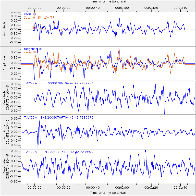
Y22A Socorro, NM, USA - Earthquake Result Viewer
*The percent match for this event was below the threshold and hence no stack was calculated.
| Earthquake location: |
South Of Fiji Islands |
| Earthquake latitude/longitude: |
-25.5/-176.4 |
| Earthquake time(UTC): |
2008/07/06 (188) 04:30:26 GMT |
| Earthquake Depth: |
49 km |
| Earthquake Magnitude: |
5.5 MB, 5.3 MS |
| Earthquake Catalog/Contributor: |
WHDF/NEIC |
|
| Network: |
TA USArray Transportable Network (new EarthScope stations) |
| Station: |
Y22A Socorro, NM, USA |
| Lat/Lon: |
33.94 N/106.97 W |
| Elevation: |
1674 m |
|
| Distance: |
88.5 deg |
| Az: |
51.118 deg |
| Baz: |
237.826 deg |
| Ray Param: |
$rayparam |
*The percent match for this event was below the threshold and hence was not used in the summary stack. |
|
| Radial Match: |
53.00163 % |
| Radial Bump: |
400 |
| Transverse Match: |
65.90536 % |
| Transverse Bump: |
400 |
| SOD ConfigId: |
2504 |
| Insert Time: |
2010-03-06 17:03:22.824 +0000 |
| GWidth: |
2.5 |
| Max Bumps: |
400 |
| Tol: |
0.001 |
|
Signal To Noise
| Channel | StoN | STA | LTA |
| TA:Y22A: :BHZ:20080706T04:42:42.723997Z | 6.3097525 | 2.8508975E-7 | 4.51824E-8 |
| TA:Y22A: :BHN:20080706T04:42:42.723997Z | 1.8505745 | 8.593788E-8 | 4.6438487E-8 |
| TA:Y22A: :BHE:20080706T04:42:42.723997Z | 1.7350051 | 1.7499701E-7 | 1.00862536E-7 |
| Arrivals |
| Ps | |
| PpPs | |
| PsPs/PpSs | |


