You are here: Home > Network List > TA - USArray Transportable Network (new EarthScope stations) Stations List
> Station Y22A Socorro, NM, USA > Earthquake Result Viewer
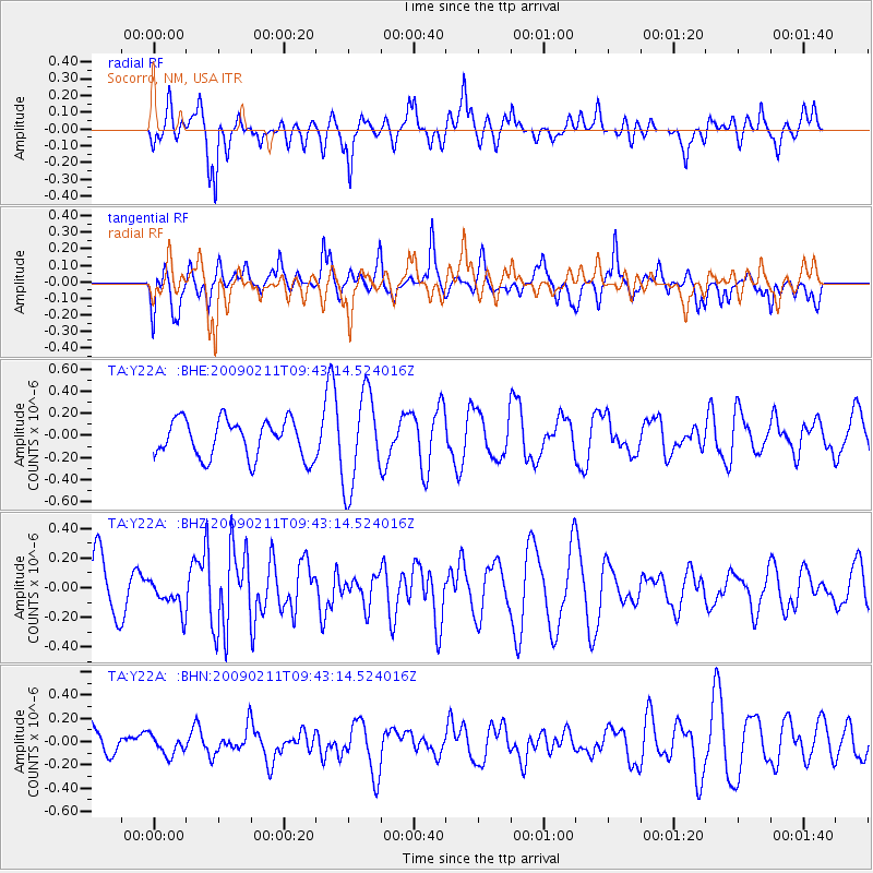
Y22A Socorro, NM, USA - Earthquake Result Viewer
*The percent match for this event was below the threshold and hence no stack was calculated.
| Earthquake location: |
Fiji Islands Region |
| Earthquake latitude/longitude: |
-20.8/-177.3 |
| Earthquake time(UTC): |
2009/02/11 (042) 09:31:04 GMT |
| Earthquake Depth: |
10 km |
| Earthquake Magnitude: |
5.5 MB, 5.2 MS, 5.5 MW, 5.5 MW |
| Earthquake Catalog/Contributor: |
WHDF/NEIC |
|
| Network: |
TA USArray Transportable Network (new EarthScope stations) |
| Station: |
Y22A Socorro, NM, USA |
| Lat/Lon: |
33.94 N/106.97 W |
| Elevation: |
1674 m |
|
| Distance: |
86.2 deg |
| Az: |
51.683 deg |
| Baz: |
242.018 deg |
| Ray Param: |
$rayparam |
*The percent match for this event was below the threshold and hence was not used in the summary stack. |
|
| Radial Match: |
53.071346 % |
| Radial Bump: |
400 |
| Transverse Match: |
51.108936 % |
| Transverse Bump: |
400 |
| SOD ConfigId: |
2658 |
| Insert Time: |
2010-03-06 17:03:24.729 +0000 |
| GWidth: |
2.5 |
| Max Bumps: |
400 |
| Tol: |
0.001 |
|
Signal To Noise
| Channel | StoN | STA | LTA |
| TA:Y22A: :BHZ:20090211T09:43:14.524016Z | 0.68360835 | 1.02551375E-7 | 1.5001481E-7 |
| TA:Y22A: :BHN:20090211T09:43:14.524016Z | 0.48992035 | 8.687136E-8 | 1.773173E-7 |
| TA:Y22A: :BHE:20090211T09:43:14.524016Z | 2.4882433 | 4.235074E-7 | 1.7020336E-7 |
| Arrivals |
| Ps | |
| PpPs | |
| PsPs/PpSs | |


