You are here: Home > Network List > TA - USArray Transportable Network (new EarthScope stations) Stations List
> Station Y22A Socorro, NM, USA > Earthquake Result Viewer
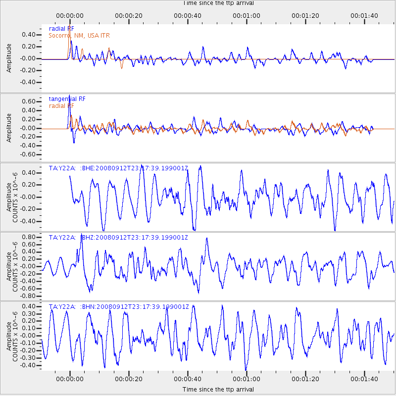
Y22A Socorro, NM, USA - Earthquake Result Viewer
*The percent match for this event was below the threshold and hence no stack was calculated.
| Earthquake location: |
Komandorskiye Ostrova Region |
| Earthquake latitude/longitude: |
56.3/164.1 |
| Earthquake time(UTC): |
2008/09/12 (256) 23:07:50 GMT |
| Earthquake Depth: |
9.3 km |
| Earthquake Magnitude: |
5.5 MB, 5.7 MS, 5.9 MW, 5.9 MW |
| Earthquake Catalog/Contributor: |
WHDF/NEIC |
|
| Network: |
TA USArray Transportable Network (new EarthScope stations) |
| Station: |
Y22A Socorro, NM, USA |
| Lat/Lon: |
33.94 N/106.97 W |
| Elevation: |
1674 m |
|
| Distance: |
62.0 deg |
| Az: |
70.338 deg |
| Baz: |
320.855 deg |
| Ray Param: |
$rayparam |
*The percent match for this event was below the threshold and hence was not used in the summary stack. |
|
| Radial Match: |
56.691788 % |
| Radial Bump: |
400 |
| Transverse Match: |
49.22792 % |
| Transverse Bump: |
400 |
| SOD ConfigId: |
2560 |
| Insert Time: |
2010-03-06 17:03:37.582 +0000 |
| GWidth: |
2.5 |
| Max Bumps: |
400 |
| Tol: |
0.001 |
|
Signal To Noise
| Channel | StoN | STA | LTA |
| TA:Y22A: :BHZ:20080912T23:17:39.199001Z | 3.625785 | 3.4482193E-7 | 9.510269E-8 |
| TA:Y22A: :BHN:20080912T23:17:39.199001Z | 1.1945083 | 2.2777076E-7 | 1.9068159E-7 |
| TA:Y22A: :BHE:20080912T23:17:39.199001Z | 0.54693943 | 1.3669015E-7 | 2.4991826E-7 |
| Arrivals |
| Ps | |
| PpPs | |
| PsPs/PpSs | |


