You are here: Home > Network List > TS - TERRAscope (Southern California Seismic Network) Stations List
> Station BAR Barrett Dam, California, USA > Earthquake Result Viewer
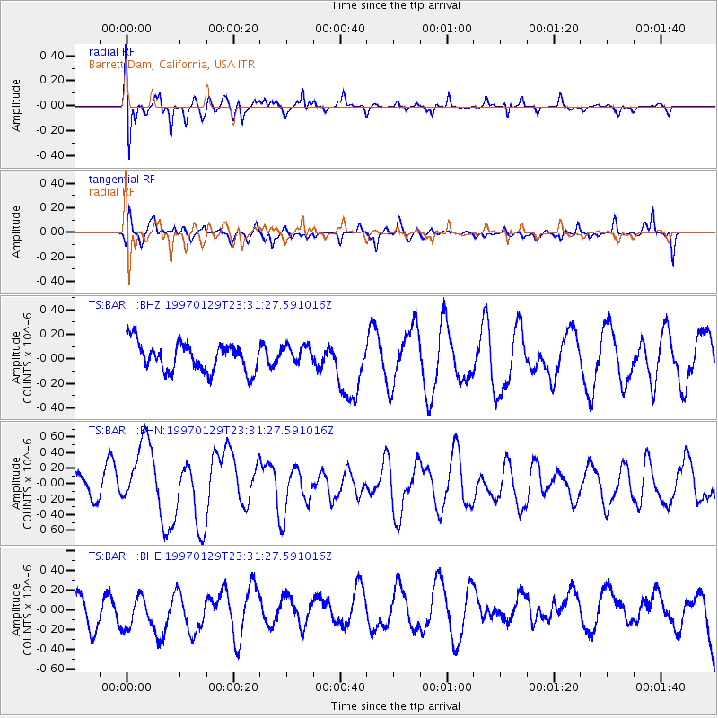
BAR Barrett Dam, California, USA - Earthquake Result Viewer
*The percent match for this event was below the threshold and hence no stack was calculated.
| Earthquake location: |
Santa Cruz Islands |
| Earthquake latitude/longitude: |
-12.9/166.4 |
| Earthquake time(UTC): |
1997/01/29 (029) 23:19:20 GMT |
| Earthquake Depth: |
33 km |
| Earthquake Magnitude: |
5.5 MB, 6.0 MS, 6.2 UNKNOWN, 6.0 MW |
| Earthquake Catalog/Contributor: |
WHDF/NEIC |
|
| Network: |
TS TERRAscope (Southern California Seismic Network) |
| Station: |
BAR Barrett Dam, California, USA |
| Lat/Lon: |
32.68 N/116.67 W |
| Elevation: |
548 m |
|
| Distance: |
86.2 deg |
| Az: |
55.425 deg |
| Baz: |
252.175 deg |
| Ray Param: |
$rayparam |
*The percent match for this event was below the threshold and hence was not used in the summary stack. |
|
| Radial Match: |
58.989647 % |
| Radial Bump: |
400 |
| Transverse Match: |
40.128506 % |
| Transverse Bump: |
358 |
| SOD ConfigId: |
4480 |
| Insert Time: |
2010-02-26 13:59:21.154 +0000 |
| GWidth: |
2.5 |
| Max Bumps: |
400 |
| Tol: |
0.001 |
|
Signal To Noise
| Channel | StoN | STA | LTA |
| TS:BAR: :BHN:19970129T23:31:27.591016Z | 2.6282668 | 5.0212503E-7 | 1.9104797E-7 |
| TS:BAR: :BHE:19970129T23:31:27.591016Z | 0.8087868 | 1.5083617E-7 | 1.8649683E-7 |
| TS:BAR: :BHZ:19970129T23:31:27.591016Z | 0.6779751 | 7.933979E-8 | 1.1702463E-7 |
| Arrivals |
| Ps | |
| PpPs | |
| PsPs/PpSs | |


