You are here: Home > Network List > TA - USArray Transportable Network (new EarthScope stations) Stations List
> Station L15K Ungalak Mountain, AK, USA > Earthquake Result Viewer
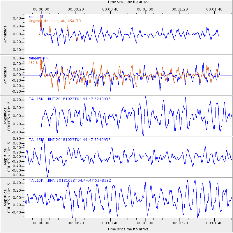
L15K Ungalak Mountain, AK, USA - Earthquake Result Viewer
*The percent match for this event was below the threshold and hence no stack was calculated.
| Earthquake location: |
Taiwan Region |
| Earthquake latitude/longitude: |
24.1/122.6 |
| Earthquake time(UTC): |
2018/10/23 (296) 04:34:58 GMT |
| Earthquake Depth: |
34 km |
| Earthquake Magnitude: |
5.7 Mww |
| Earthquake Catalog/Contributor: |
NEIC PDE/us |
|
| Network: |
TA USArray Transportable Network (new EarthScope stations) |
| Station: |
L15K Ungalak Mountain, AK, USA |
| Lat/Lon: |
61.68 N/161.49 W |
| Elevation: |
219 m |
|
| Distance: |
62.4 deg |
| Az: |
31.454 deg |
| Baz: |
269.861 deg |
| Ray Param: |
$rayparam |
*The percent match for this event was below the threshold and hence was not used in the summary stack. |
|
| Radial Match: |
62.903065 % |
| Radial Bump: |
400 |
| Transverse Match: |
61.5747 % |
| Transverse Bump: |
350 |
| SOD ConfigId: |
13570011 |
| Insert Time: |
2019-05-01 14:27:41.403 +0000 |
| GWidth: |
2.5 |
| Max Bumps: |
400 |
| Tol: |
0.001 |
|
Signal To Noise
| Channel | StoN | STA | LTA |
| TA:L15K: :BHZ:20181023T04:44:47.524993Z | 2.8620546 | 5.483714E-7 | 1.9160062E-7 |
| TA:L15K: :BHN:20181023T04:44:47.524993Z | 0.52996624 | 9.944359E-8 | 1.8764136E-7 |
| TA:L15K: :BHE:20181023T04:44:47.524993Z | 0.890106 | 1.3177727E-7 | 1.4804672E-7 |
| Arrivals |
| Ps | |
| PpPs | |
| PsPs/PpSs | |


