You are here: Home > Network List > TA - USArray Transportable Network (new EarthScope stations) Stations List
> Station O18K Koktuh Hills, AK, USA > Earthquake Result Viewer
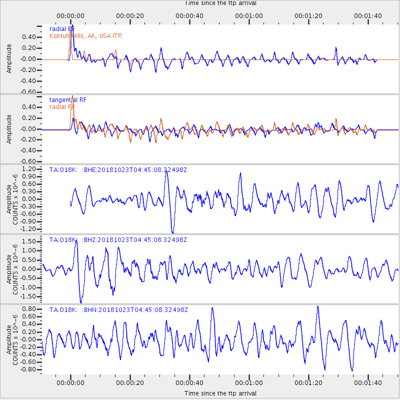
O18K Koktuh Hills, AK, USA - Earthquake Result Viewer
*The percent match for this event was below the threshold and hence no stack was calculated.
| Earthquake location: |
Taiwan Region |
| Earthquake latitude/longitude: |
24.1/122.6 |
| Earthquake time(UTC): |
2018/10/23 (296) 04:34:58 GMT |
| Earthquake Depth: |
34 km |
| Earthquake Magnitude: |
5.7 Mww |
| Earthquake Catalog/Contributor: |
NEIC PDE/us |
|
| Network: |
TA USArray Transportable Network (new EarthScope stations) |
| Station: |
O18K Koktuh Hills, AK, USA |
| Lat/Lon: |
59.85 N/155.21 W |
| Elevation: |
544 m |
|
| Distance: |
65.6 deg |
| Az: |
33.305 deg |
| Baz: |
276.145 deg |
| Ray Param: |
$rayparam |
*The percent match for this event was below the threshold and hence was not used in the summary stack. |
|
| Radial Match: |
73.80134 % |
| Radial Bump: |
400 |
| Transverse Match: |
53.159958 % |
| Transverse Bump: |
400 |
| SOD ConfigId: |
13570011 |
| Insert Time: |
2019-05-01 14:28:04.250 +0000 |
| GWidth: |
2.5 |
| Max Bumps: |
400 |
| Tol: |
0.001 |
|
Signal To Noise
| Channel | StoN | STA | LTA |
| TA:O18K: :BHZ:20181023T04:45:08.32498Z | 4.1090307 | 1.0102788E-6 | 2.4586794E-7 |
| TA:O18K: :BHN:20181023T04:45:08.32498Z | 0.5846446 | 1.6644212E-7 | 2.8468938E-7 |
| TA:O18K: :BHE:20181023T04:45:08.32498Z | 3.4223125 | 7.2107525E-7 | 2.1069826E-7 |
| Arrivals |
| Ps | |
| PpPs | |
| PsPs/PpSs | |


