You are here: Home > Network List > UW - Pacific Northwest Regional Seismic Network Stations List
> Station FISH Seaside, OR, USA > Earthquake Result Viewer
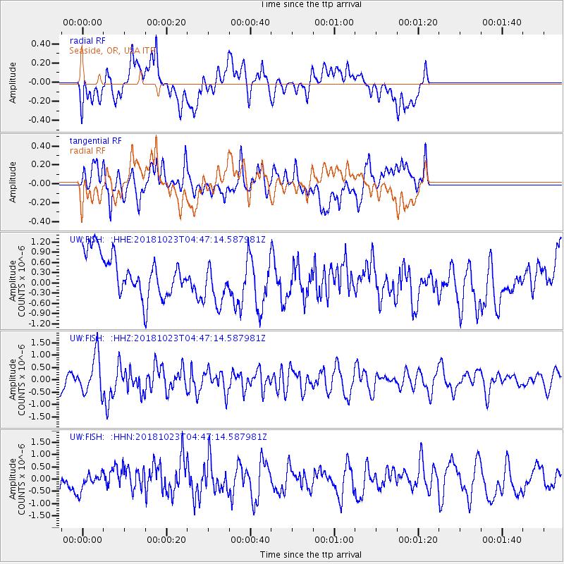
FISH Seaside, OR, USA - Earthquake Result Viewer
*The percent match for this event was below the threshold and hence no stack was calculated.
| Earthquake location: |
Taiwan Region |
| Earthquake latitude/longitude: |
24.1/122.6 |
| Earthquake time(UTC): |
2018/10/23 (296) 04:34:58 GMT |
| Earthquake Depth: |
34 km |
| Earthquake Magnitude: |
5.7 Mww |
| Earthquake Catalog/Contributor: |
NEIC PDE/us |
|
| Network: |
UW Pacific Northwest Regional Seismic Network |
| Station: |
FISH Seaside, OR, USA |
| Lat/Lon: |
45.93 N/123.56 W |
| Elevation: |
325 m |
|
| Distance: |
88.1 deg |
| Az: |
39.703 deg |
| Baz: |
303.229 deg |
| Ray Param: |
$rayparam |
*The percent match for this event was below the threshold and hence was not used in the summary stack. |
|
| Radial Match: |
47.187183 % |
| Radial Bump: |
400 |
| Transverse Match: |
53.605232 % |
| Transverse Bump: |
400 |
| SOD ConfigId: |
13570011 |
| Insert Time: |
2019-05-01 14:28:47.316 +0000 |
| GWidth: |
2.5 |
| Max Bumps: |
400 |
| Tol: |
0.001 |
|
Signal To Noise
| Channel | StoN | STA | LTA |
| UW:FISH: :HHZ:20181023T04:47:14.587981Z | 3.4024615 | 8.029392E-7 | 2.3598774E-7 |
| UW:FISH: :HHN:20181023T04:47:14.587981Z | 0.8200748 | 3.2959628E-7 | 4.0191003E-7 |
| UW:FISH: :HHE:20181023T04:47:14.587981Z | 1.1147304 | 6.707158E-7 | 6.0168435E-7 |
| Arrivals |
| Ps | |
| PpPs | |
| PsPs/PpSs | |


