You are here: Home > Network List > UW - Pacific Northwest Regional Seismic Network Stations List
> Station UMAT Pilot Rock, OR, USA > Earthquake Result Viewer
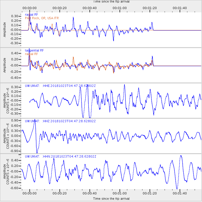
UMAT Pilot Rock, OR, USA - Earthquake Result Viewer
*The percent match for this event was below the threshold and hence no stack was calculated.
| Earthquake location: |
Taiwan Region |
| Earthquake latitude/longitude: |
24.1/122.6 |
| Earthquake time(UTC): |
2018/10/23 (296) 04:34:58 GMT |
| Earthquake Depth: |
34 km |
| Earthquake Magnitude: |
5.7 Mww |
| Earthquake Catalog/Contributor: |
NEIC PDE/us |
|
| Network: |
UW Pacific Northwest Regional Seismic Network |
| Station: |
UMAT Pilot Rock, OR, USA |
| Lat/Lon: |
45.29 N/118.96 W |
| Elevation: |
1318 m |
|
| Distance: |
91.1 deg |
| Az: |
38.383 deg |
| Baz: |
306.497 deg |
| Ray Param: |
$rayparam |
*The percent match for this event was below the threshold and hence was not used in the summary stack. |
|
| Radial Match: |
65.30741 % |
| Radial Bump: |
395 |
| Transverse Match: |
50.56635 % |
| Transverse Bump: |
400 |
| SOD ConfigId: |
13570011 |
| Insert Time: |
2019-05-01 14:29:08.007 +0000 |
| GWidth: |
2.5 |
| Max Bumps: |
400 |
| Tol: |
0.001 |
|
Signal To Noise
| Channel | StoN | STA | LTA |
| UW:UMAT: :HHZ:20181023T04:47:28.62802Z | 2.955997 | 5.0810286E-7 | 1.7188884E-7 |
| UW:UMAT: :HHN:20181023T04:47:28.62802Z | 1.4118403 | 2.234689E-7 | 1.5828199E-7 |
| UW:UMAT: :HHE:20181023T04:47:28.62802Z | 1.8809507 | 1.3572198E-7 | 7.2156055E-8 |
| Arrivals |
| Ps | |
| PpPs | |
| PsPs/PpSs | |


