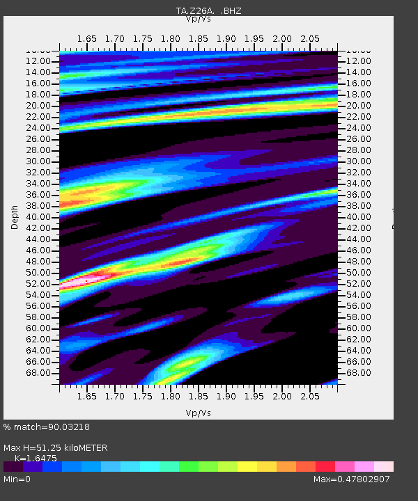
Z26A Caprock, NM, USA - Earthquake Result Viewer
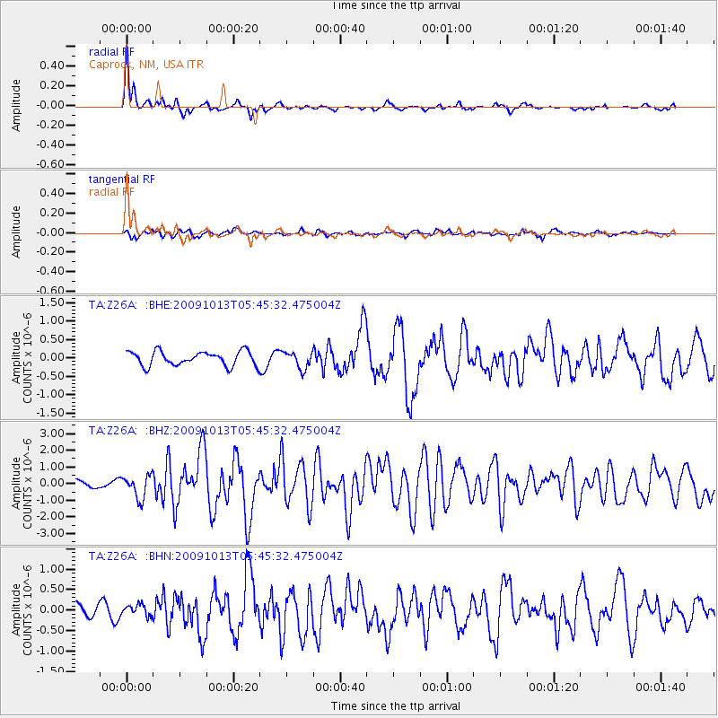
Earthquake location: Fox Islands, Aleutian Islands
Earthquake latitude/longitude: 52.8/-167.0
Earthquake time(UTC): 2009/10/13 (286) 05:37:23 GMT
Earthquake Depth: 24 km
Earthquake Magnitude: 6.0 MB, 6.1 MS, 6.5 MW, 6.5 MW
Earthquake Catalog/Contributor: WHDF/NEIC
Network: TA USArray Transportable Network (new EarthScope stations)
Station: Z26A Caprock, NM, USA
Lat/Lon: 33.27 N/103.98 W
Elevation: 1163 m
Distance: 48.3 deg
Az: 87.695 deg
Baz: 313.537 deg
Ray Param: 0.06938482
Estimated Moho Depth: 51.25 km
Estimated Crust Vp/Vs: 1.65
Assumed Crust Vp: 6.129 km/s
Estimated Crust Vs: 3.72 km/s
Estimated Crust Poisson's Ratio: 0.21
Radial Match: 90.03218 %
Radial Bump: 347
Transverse Match: 76.45329 %
Transverse Bump: 400
SOD ConfigId: 2622
Insert Time: 2010-03-06 17:04:31.586 +0000
GWidth: 2.5
Max Bumps: 400
Tol: 0.001

Signal To Noise

ChannelStoNSTALTA
TA:Z26A: :BHZ:20091013T05:45:32.475004Z3.08028536.939677E-72.2529332E-7
TA:Z26A: :BHN:20091013T05:45:32.475004Z0.839828131.3739844E-71.6360305E-7
TA:Z26A: :BHE:20091013T05:45:32.475004Z1.20369492.3195577E-71.9270313E-7
Arrivals
Ps5.7 SECOND
PpPs21 SECOND
PsPs/PpSs27 SECOND