Z26A Caprock, NM, USA - Earthquake Result Viewer
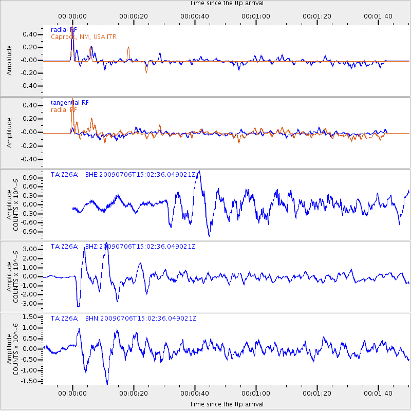
Earthquake location: Rat Islands, Aleutian Islands
Earthquake latitude/longitude: 50.4/177.0
Earthquake time(UTC): 2009/07/06 (187) 14:53:12 GMT
Earthquake Depth: 22 km
Earthquake Magnitude: 6.0 MB, 5.8 MS, 6.1 MW, 6.0 MW
Earthquake Catalog/Contributor: WHDF/NEIC
Network: TA USArray Transportable Network (new EarthScope stations)
Station: Z26A Caprock, NM, USA
Lat/Lon: 33.27 N/103.98 W
Elevation: 1163 m
Distance: 58.5 deg
Az: 74.596 deg
Baz: 312.616 deg
Ray Param: 0.06274314
Estimated Moho Depth: 39.75 km
Estimated Crust Vp/Vs: 1.93
Assumed Crust Vp: 6.129 km/s
Estimated Crust Vs: 3.18 km/s
Estimated Crust Poisson's Ratio: 0.32
Radial Match: 91.43572 %
Radial Bump: 400
Transverse Match: 69.31976 %
Transverse Bump: 400
SOD ConfigId: 2648
Insert Time: 2010-03-06 17:04:50.375 +0000
GWidth: 2.5
Max Bumps: 400
Tol: 0.001

Signal To Noise

ChannelStoNSTALTA
TA:Z26A: :BHZ:20090706T15:02:36.049021Z10.2920091.7984104E-61.7473852E-7
TA:Z26A: :BHN:20090706T15:02:36.049021Z5.1536145.679564E-71.1020547E-7
TA:Z26A: :BHE:20090706T15:02:36.049021Z2.5801063.5004112E-71.3566928E-7
Arrivals
Ps6.3 SECOND
PpPs18 SECOND
PsPs/PpSs24 SECOND