You are here: Home > Network List > TA - USArray Transportable Network (new EarthScope stations) Stations List
> Station H31M Peel River, Yukon, CAN > Earthquake Result Viewer
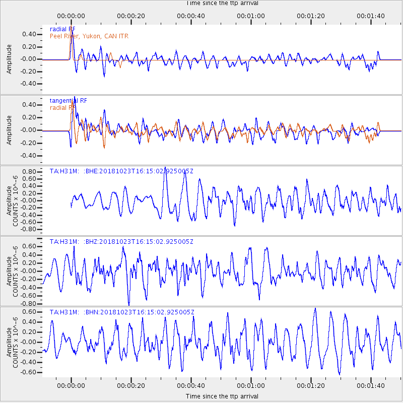
H31M Peel River, Yukon, CAN - Earthquake Result Viewer
*The percent match for this event was below the threshold and hence no stack was calculated.
| Earthquake location: |
Taiwan Region |
| Earthquake latitude/longitude: |
24.0/122.7 |
| Earthquake time(UTC): |
2018/10/23 (296) 16:04:04 GMT |
| Earthquake Depth: |
31 km |
| Earthquake Magnitude: |
5.7 Mww |
| Earthquake Catalog/Contributor: |
NEIC PDE/us |
|
| Network: |
TA USArray Transportable Network (new EarthScope stations) |
| Station: |
H31M Peel River, Yukon, CAN |
| Lat/Lon: |
65.81 N/134.34 W |
| Elevation: |
642 m |
|
| Distance: |
73.5 deg |
| Az: |
24.763 deg |
| Baz: |
291.621 deg |
| Ray Param: |
$rayparam |
*The percent match for this event was below the threshold and hence was not used in the summary stack. |
|
| Radial Match: |
39.780003 % |
| Radial Bump: |
393 |
| Transverse Match: |
49.486866 % |
| Transverse Bump: |
400 |
| SOD ConfigId: |
13570011 |
| Insert Time: |
2019-05-01 14:36:07.166 +0000 |
| GWidth: |
2.5 |
| Max Bumps: |
400 |
| Tol: |
0.001 |
|
Signal To Noise
| Channel | StoN | STA | LTA |
| TA:H31M: :BHZ:20181023T16:15:02.925005Z | 1.3147042 | 2.3688332E-7 | 1.8017994E-7 |
| TA:H31M: :BHN:20181023T16:15:02.925005Z | 0.37945718 | 1.5142584E-7 | 3.990591E-7 |
| TA:H31M: :BHE:20181023T16:15:02.925005Z | 2.43811 | 4.4084126E-7 | 1.808127E-7 |
| Arrivals |
| Ps | |
| PpPs | |
| PsPs/PpSs | |


