You are here: Home > Network List > TJ - Tajikistan National Seismic Network Stations List
> Station GARM Garm, Tajikistan > Earthquake Result Viewer
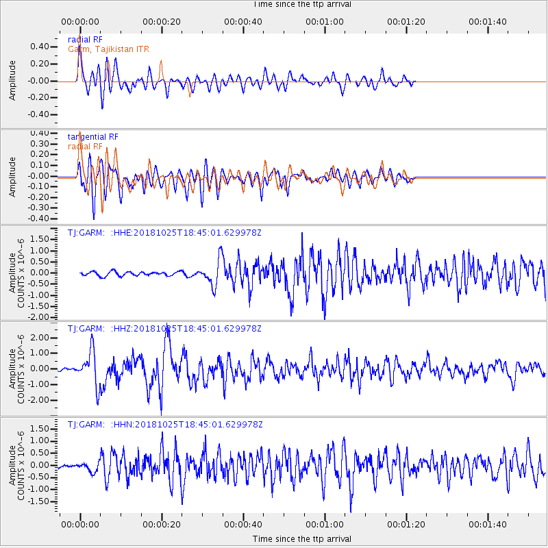
GARM Garm, Tajikistan - Earthquake Result Viewer
*The percent match for this event was below the threshold and hence no stack was calculated.
| Earthquake location: |
Near East Coast Of Honshu, Japan |
| Earthquake latitude/longitude: |
38.3/141.8 |
| Earthquake time(UTC): |
2018/10/25 (298) 18:36:09 GMT |
| Earthquake Depth: |
40 km |
| Earthquake Magnitude: |
5.7 Mww |
| Earthquake Catalog/Contributor: |
NEIC PDE/us |
|
| Network: |
TJ Tajikistan National Seismic Network |
| Station: |
GARM Garm, Tajikistan |
| Lat/Lon: |
39.00 N/70.32 E |
| Elevation: |
1305 m |
|
| Distance: |
54.4 deg |
| Az: |
294.72 deg |
| Baz: |
66.493 deg |
| Ray Param: |
$rayparam |
*The percent match for this event was below the threshold and hence was not used in the summary stack. |
|
| Radial Match: |
76.77904 % |
| Radial Bump: |
400 |
| Transverse Match: |
81.02154 % |
| Transverse Bump: |
400 |
| SOD ConfigId: |
13570011 |
| Insert Time: |
2019-05-01 14:46:30.206 +0000 |
| GWidth: |
2.5 |
| Max Bumps: |
400 |
| Tol: |
0.001 |
|
Signal To Noise
| Channel | StoN | STA | LTA |
| TJ:GARM: :HHZ:20181025T18:45:01.629978Z | 10.42737 | 1.1263851E-6 | 1.08021965E-7 |
| TJ:GARM: :HHN:20181025T18:45:01.629978Z | 1.6372819 | 1.8891909E-7 | 1.1538581E-7 |
| TJ:GARM: :HHE:20181025T18:45:01.629978Z | 6.414688 | 5.9116076E-7 | 9.2157364E-8 |
| Arrivals |
| Ps | |
| PpPs | |
| PsPs/PpSs | |


