You are here: Home > Network List > TA - USArray Transportable Network (new EarthScope stations) Stations List
> Station Z26A Caprock, NM, USA > Earthquake Result Viewer
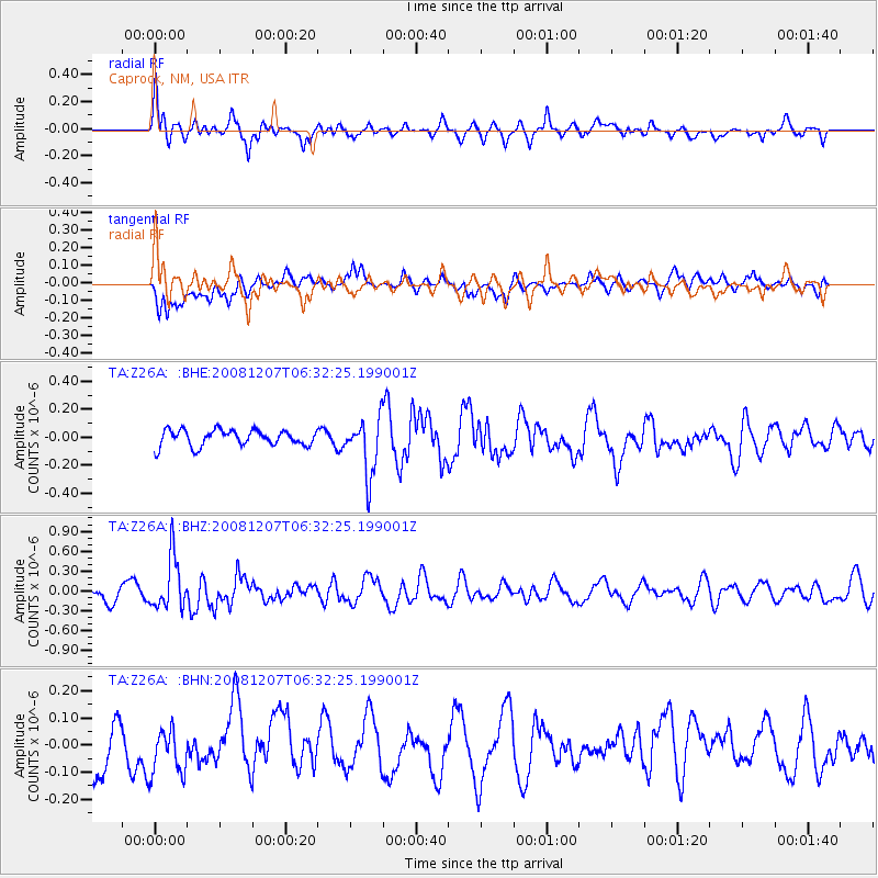
Z26A Caprock, NM, USA - Earthquake Result Viewer
*The percent match for this event was below the threshold and hence no stack was calculated.
| Earthquake location: |
Northern Mid-Atlantic Ridge |
| Earthquake latitude/longitude: |
13.4/-44.8 |
| Earthquake time(UTC): |
2008/12/07 (342) 06:23:09 GMT |
| Earthquake Depth: |
10 km |
| Earthquake Magnitude: |
5.6 MB, 5.3 MS, 5.7 MW |
| Earthquake Catalog/Contributor: |
WHDF/NEIC |
|
| Network: |
TA USArray Transportable Network (new EarthScope stations) |
| Station: |
Z26A Caprock, NM, USA |
| Lat/Lon: |
33.27 N/103.98 W |
| Elevation: |
1163 m |
|
| Distance: |
57.1 deg |
| Az: |
301.043 deg |
| Baz: |
95.488 deg |
| Ray Param: |
$rayparam |
*The percent match for this event was below the threshold and hence was not used in the summary stack. |
|
| Radial Match: |
64.516045 % |
| Radial Bump: |
400 |
| Transverse Match: |
51.377422 % |
| Transverse Bump: |
400 |
| SOD ConfigId: |
2658 |
| Insert Time: |
2010-03-06 17:06:23.183 +0000 |
| GWidth: |
2.5 |
| Max Bumps: |
400 |
| Tol: |
0.001 |
|
Signal To Noise
| Channel | StoN | STA | LTA |
| TA:Z26A: :BHZ:20081207T06:32:25.199001Z | 3.2647474 | 3.894105E-7 | 1.1927737E-7 |
| TA:Z26A: :BHN:20081207T06:32:25.199001Z | 1.1158729 | 9.567852E-8 | 8.574321E-8 |
| TA:Z26A: :BHE:20081207T06:32:25.199001Z | 3.5734146 | 2.034773E-7 | 5.694198E-8 |
| Arrivals |
| Ps | |
| PpPs | |
| PsPs/PpSs | |


