You are here: Home > Network List > TS - TERRAscope (Southern California Seismic Network) Stations List
> Station BAR Barrett Dam, California, USA > Earthquake Result Viewer
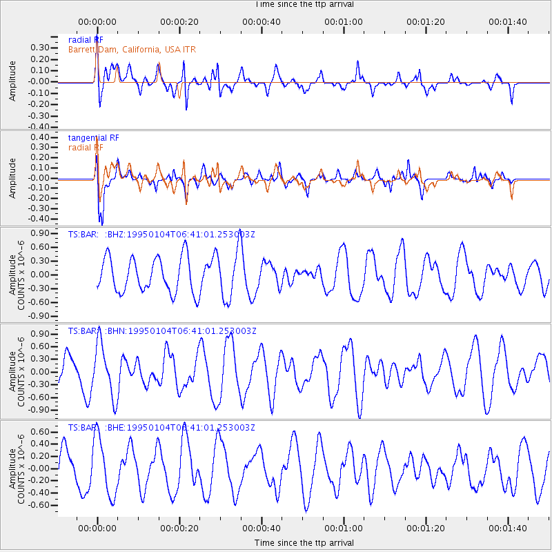
BAR Barrett Dam, California, USA - Earthquake Result Viewer
*The percent match for this event was below the threshold and hence no stack was calculated.
| Earthquake location: |
Southern East Pacific Rise |
| Earthquake latitude/longitude: |
-56.1/-123.2 |
| Earthquake time(UTC): |
1995/01/04 (004) 06:28:39 GMT |
| Earthquake Depth: |
10 km |
| Earthquake Magnitude: |
5.8 MS, 5.1 MB, 6.0 UNKNOWN |
| Earthquake Catalog/Contributor: |
WHDF/NEIC |
|
| Network: |
TS TERRAscope (Southern California Seismic Network) |
| Station: |
BAR Barrett Dam, California, USA |
| Lat/Lon: |
32.68 N/116.67 W |
| Elevation: |
548 m |
|
| Distance: |
88.6 deg |
| Az: |
5.464 deg |
| Baz: |
183.628 deg |
| Ray Param: |
$rayparam |
*The percent match for this event was below the threshold and hence was not used in the summary stack. |
|
| Radial Match: |
51.181828 % |
| Radial Bump: |
400 |
| Transverse Match: |
70.10854 % |
| Transverse Bump: |
400 |
| SOD ConfigId: |
4480 |
| Insert Time: |
2010-02-26 13:59:26.440 +0000 |
| GWidth: |
2.5 |
| Max Bumps: |
400 |
| Tol: |
0.001 |
|
Signal To Noise
| Channel | StoN | STA | LTA |
| TS:BAR: :BHN:19950104T06:41:01.253003Z | 1.7077168 | 6.426885E-7 | 3.7634373E-7 |
| TS:BAR: :BHE:19950104T06:41:01.253003Z | 1.6535051 | 4.919708E-7 | 2.975321E-7 |
| TS:BAR: :BHZ:19950104T06:41:01.253003Z | 1.4525506 | 5.4570705E-7 | 3.756888E-7 |
| Arrivals |
| Ps | |
| PpPs | |
| PsPs/PpSs | |


