You are here: Home > Network List > TA - USArray Transportable Network (new EarthScope stations) Stations List
> Station Z26A Caprock, NM, USA > Earthquake Result Viewer
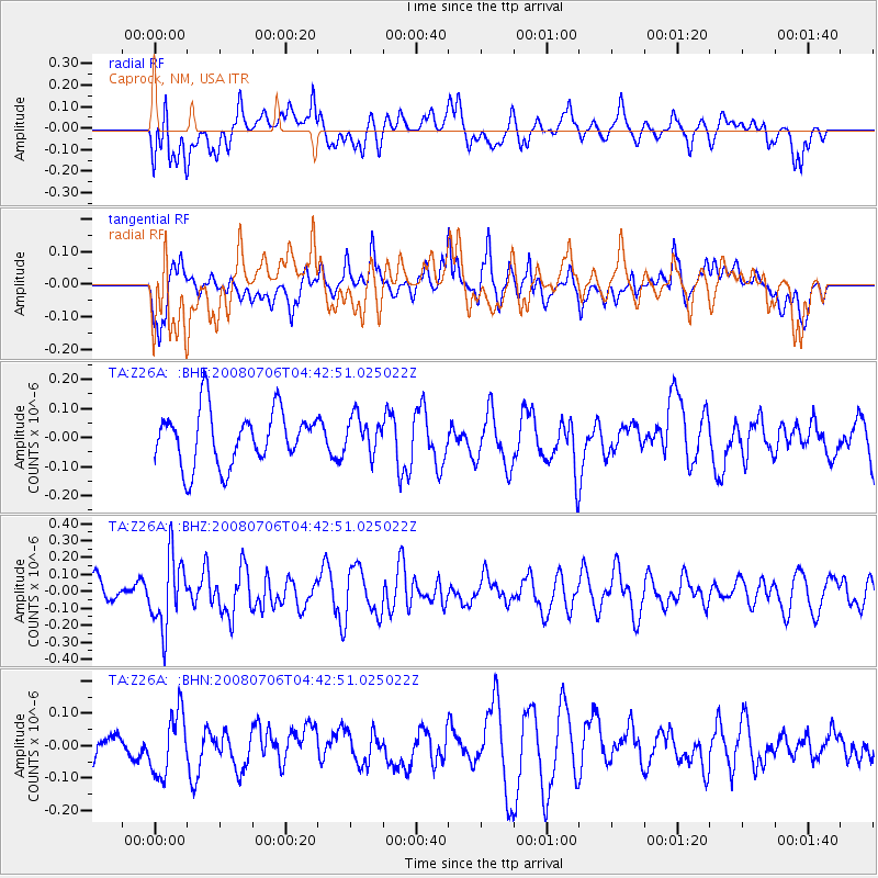
Z26A Caprock, NM, USA - Earthquake Result Viewer
*The percent match for this event was below the threshold and hence no stack was calculated.
| Earthquake location: |
South Of Fiji Islands |
| Earthquake latitude/longitude: |
-25.5/-176.4 |
| Earthquake time(UTC): |
2008/07/06 (188) 04:30:26 GMT |
| Earthquake Depth: |
49 km |
| Earthquake Magnitude: |
5.5 MB, 5.3 MS |
| Earthquake Catalog/Contributor: |
WHDF/NEIC |
|
| Network: |
TA USArray Transportable Network (new EarthScope stations) |
| Station: |
Z26A Caprock, NM, USA |
| Lat/Lon: |
33.27 N/103.98 W |
| Elevation: |
1163 m |
|
| Distance: |
90.2 deg |
| Az: |
52.98 deg |
| Baz: |
239.492 deg |
| Ray Param: |
$rayparam |
*The percent match for this event was below the threshold and hence was not used in the summary stack. |
|
| Radial Match: |
54.20543 % |
| Radial Bump: |
400 |
| Transverse Match: |
56.789993 % |
| Transverse Bump: |
400 |
| SOD ConfigId: |
2504 |
| Insert Time: |
2010-03-06 17:06:55.364 +0000 |
| GWidth: |
2.5 |
| Max Bumps: |
400 |
| Tol: |
0.001 |
|
Signal To Noise
| Channel | StoN | STA | LTA |
| TA:Z26A: :BHZ:20080706T04:42:51.025022Z | 1.5374687 | 2.0688721E-7 | 1.3456352E-7 |
| TA:Z26A: :BHN:20080706T04:42:51.025022Z | 1.0567486 | 9.58433E-8 | 9.0696396E-8 |
| TA:Z26A: :BHE:20080706T04:42:51.025022Z | 0.6536007 | 6.119228E-8 | 9.3623335E-8 |
| Arrivals |
| Ps | |
| PpPs | |
| PsPs/PpSs | |


