You are here: Home > Network List > TA - USArray Transportable Network (new EarthScope stations) Stations List
> Station Z26A Caprock, NM, USA > Earthquake Result Viewer
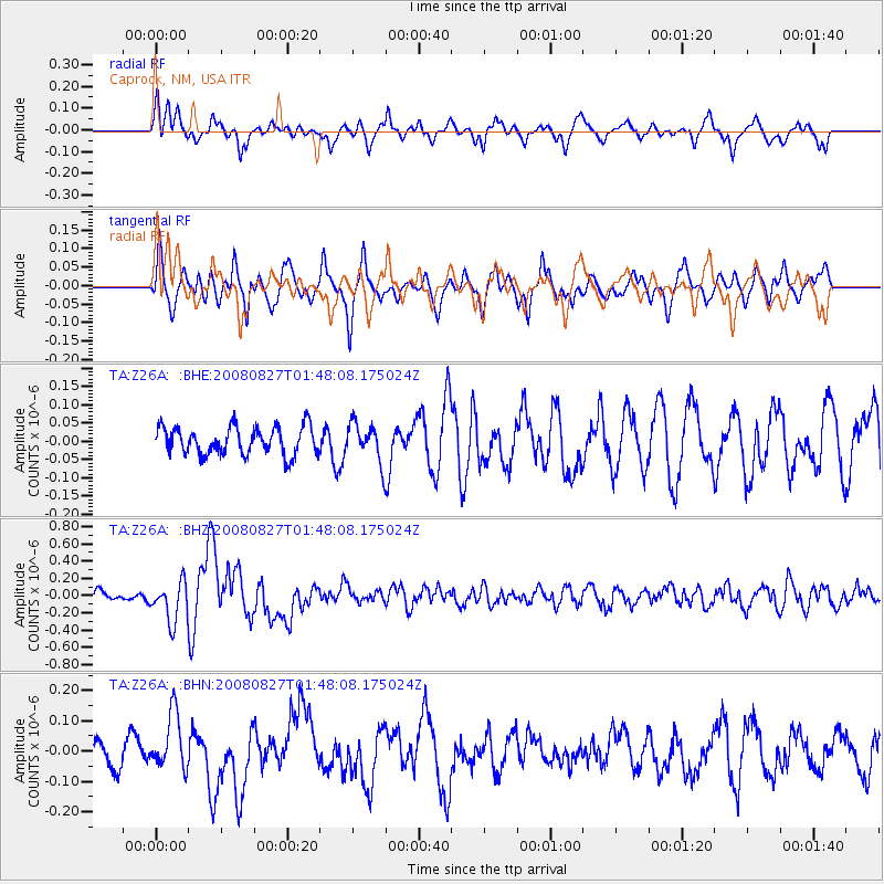
Z26A Caprock, NM, USA - Earthquake Result Viewer
*The percent match for this event was below the threshold and hence no stack was calculated.
| Earthquake location: |
Lake Baykal Region, Russia |
| Earthquake latitude/longitude: |
51.6/104.2 |
| Earthquake time(UTC): |
2008/08/27 (240) 01:35:32 GMT |
| Earthquake Depth: |
16 km |
| Earthquake Magnitude: |
5.8 MB, 6.2 MS, 6.2 MW, 6.2 MW |
| Earthquake Catalog/Contributor: |
WHDF/NEIC |
|
| Network: |
TA USArray Transportable Network (new EarthScope stations) |
| Station: |
Z26A Caprock, NM, USA |
| Lat/Lon: |
33.27 N/103.98 W |
| Elevation: |
1163 m |
|
| Distance: |
91.9 deg |
| Az: |
23.285 deg |
| Baz: |
342.887 deg |
| Ray Param: |
$rayparam |
*The percent match for this event was below the threshold and hence was not used in the summary stack. |
|
| Radial Match: |
76.352585 % |
| Radial Bump: |
400 |
| Transverse Match: |
57.47623 % |
| Transverse Bump: |
385 |
| SOD ConfigId: |
2504 |
| Insert Time: |
2010-03-06 17:07:04.977 +0000 |
| GWidth: |
2.5 |
| Max Bumps: |
400 |
| Tol: |
0.001 |
|
Signal To Noise
| Channel | StoN | STA | LTA |
| TA:Z26A: :BHZ:20080827T01:48:08.175024Z | 2.7582693 | 2.322134E-7 | 8.418808E-8 |
| TA:Z26A: :BHN:20080827T01:48:08.175024Z | 1.8968494 | 9.218148E-8 | 4.8597155E-8 |
| TA:Z26A: :BHE:20080827T01:48:08.175024Z | 1.4192033 | 5.36489E-8 | 3.7802124E-8 |
| Arrivals |
| Ps | |
| PpPs | |
| PsPs/PpSs | |


