You are here: Home > Network List > TA - USArray Transportable Network (new EarthScope stations) Stations List
> Station Z26A Caprock, NM, USA > Earthquake Result Viewer
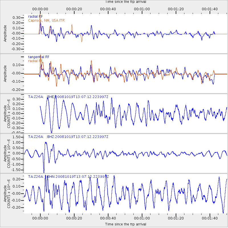
Z26A Caprock, NM, USA - Earthquake Result Viewer
*The percent match for this event was below the threshold and hence no stack was calculated.
| Earthquake location: |
Tonga Islands |
| Earthquake latitude/longitude: |
-22.0/-173.7 |
| Earthquake time(UTC): |
2008/10/19 (293) 12:55:05 GMT |
| Earthquake Depth: |
35 km |
| Earthquake Magnitude: |
5.7 MB, 5.3 MS, 5.6 MW, 5.5 MW |
| Earthquake Catalog/Contributor: |
WHDF/NEIC |
|
| Network: |
TA USArray Transportable Network (new EarthScope stations) |
| Station: |
Z26A Caprock, NM, USA |
| Lat/Lon: |
33.27 N/103.98 W |
| Elevation: |
1163 m |
|
| Distance: |
86.2 deg |
| Az: |
51.959 deg |
| Baz: |
240.765 deg |
| Ray Param: |
$rayparam |
*The percent match for this event was below the threshold and hence was not used in the summary stack. |
|
| Radial Match: |
58.541275 % |
| Radial Bump: |
400 |
| Transverse Match: |
70.03384 % |
| Transverse Bump: |
400 |
| SOD ConfigId: |
2556 |
| Insert Time: |
2010-03-06 17:07:06.766 +0000 |
| GWidth: |
2.5 |
| Max Bumps: |
400 |
| Tol: |
0.001 |
|
Signal To Noise
| Channel | StoN | STA | LTA |
| TA:Z26A: :BHZ:20081019T13:07:12.223997Z | 2.7495227 | 6.8719896E-7 | 2.4993392E-7 |
| TA:Z26A: :BHN:20081019T13:07:12.223997Z | 2.3157706 | 1.433661E-7 | 6.1908594E-8 |
| TA:Z26A: :BHE:20081019T13:07:12.223997Z | 0.68472755 | 1.3237336E-7 | 1.9332268E-7 |
| Arrivals |
| Ps | |
| PpPs | |
| PsPs/PpSs | |


