You are here: Home > Network List > US - United States National Seismic Network Stations List
> Station DGMT Dagmar, Montana, USA > Earthquake Result Viewer
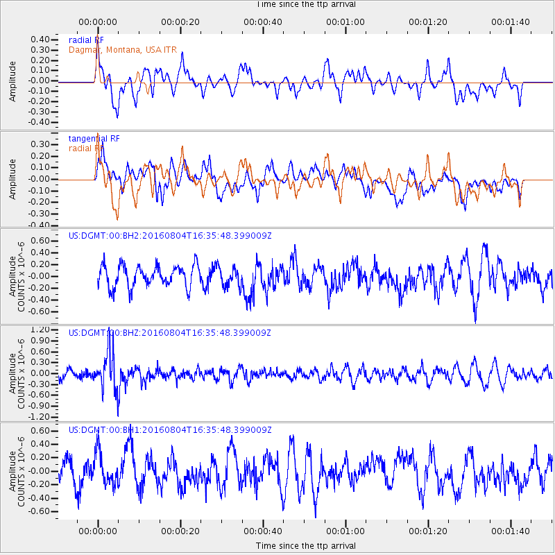
DGMT Dagmar, Montana, USA - Earthquake Result Viewer
*The percent match for this event was below the threshold and hence no stack was calculated.
| Earthquake location: |
Volcano Islands, Japan Region |
| Earthquake latitude/longitude: |
24.9/142.0 |
| Earthquake time(UTC): |
2016/08/04 (217) 16:24:33 GMT |
| Earthquake Depth: |
510 km |
| Earthquake Magnitude: |
6.3 MWW, 6.2 MWC, 6.3 MWB, 6.3 MWC |
| Earthquake Catalog/Contributor: |
NEIC PDE/NEIC COMCAT |
|
| Network: |
US United States National Seismic Network |
| Station: |
DGMT Dagmar, Montana, USA |
| Lat/Lon: |
48.47 N/104.20 W |
| Elevation: |
0.0 m |
|
| Distance: |
86.0 deg |
| Az: |
37.618 deg |
| Baz: |
303.634 deg |
| Ray Param: |
$rayparam |
*The percent match for this event was below the threshold and hence was not used in the summary stack. |
|
| Radial Match: |
56.45876 % |
| Radial Bump: |
400 |
| Transverse Match: |
45.577347 % |
| Transverse Bump: |
400 |
| SOD ConfigId: |
1634031 |
| Insert Time: |
2016-08-18 16:27:32.562 +0000 |
| GWidth: |
2.5 |
| Max Bumps: |
400 |
| Tol: |
0.001 |
|
Signal To Noise
| Channel | StoN | STA | LTA |
| US:DGMT:00:BHZ:20160804T16:35:48.399009Z | 5.3793306 | 5.3168674E-7 | 9.8838825E-8 |
| US:DGMT:00:BH1:20160804T16:35:48.399009Z | 1.8886096 | 2.384439E-7 | 1.2625367E-7 |
| US:DGMT:00:BH2:20160804T16:35:48.399009Z | 0.8734441 | 1.5623662E-7 | 1.7887422E-7 |
| Arrivals |
| Ps | |
| PpPs | |
| PsPs/PpSs | |


