You are here: Home > Network List > TA - USArray Transportable Network (new EarthScope stations) Stations List
> Station G31M Satah River, YT, CAN > Earthquake Result Viewer
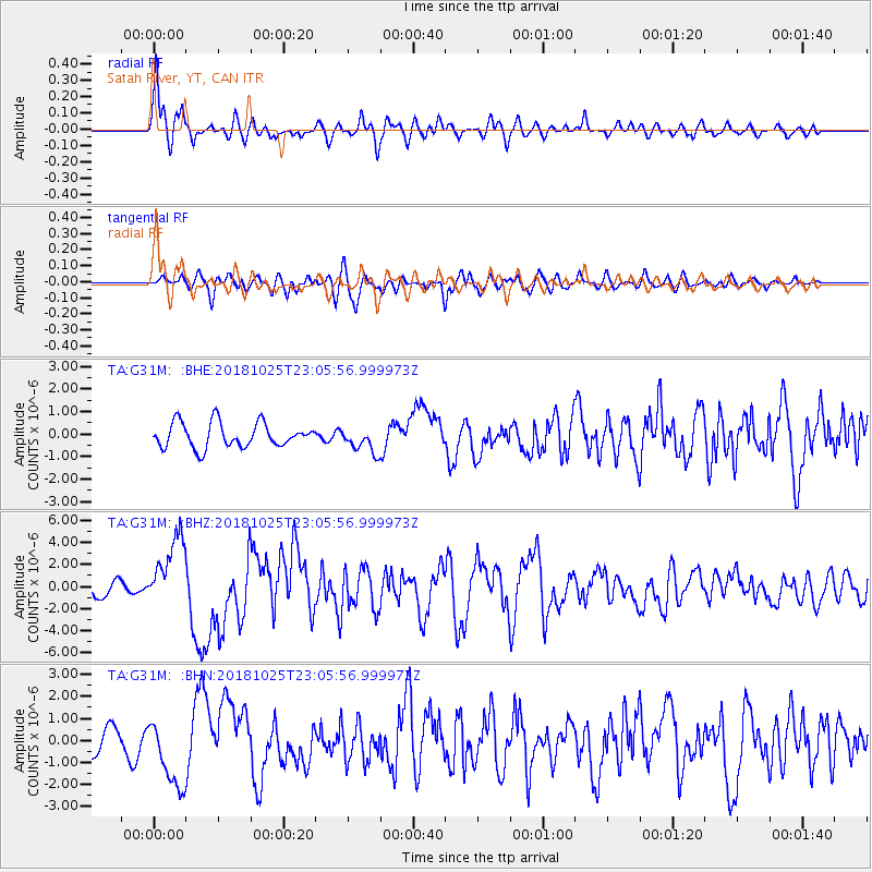
G31M Satah River, YT, CAN - Earthquake Result Viewer
*The percent match for this event was below the threshold and hence no stack was calculated.
| Earthquake location: |
Ionian Sea |
| Earthquake latitude/longitude: |
37.5/20.6 |
| Earthquake time(UTC): |
2018/10/25 (298) 22:54:52 GMT |
| Earthquake Depth: |
14 km |
| Earthquake Magnitude: |
6.8 Mww |
| Earthquake Catalog/Contributor: |
NEIC PDE/us |
|
| Network: |
TA USArray Transportable Network (new EarthScope stations) |
| Station: |
G31M Satah River, YT, CAN |
| Lat/Lon: |
66.92 N/134.27 W |
| Elevation: |
61 m |
|
| Distance: |
74.1 deg |
| Az: |
349.963 deg |
| Baz: |
20.582 deg |
| Ray Param: |
$rayparam |
*The percent match for this event was below the threshold and hence was not used in the summary stack. |
|
| Radial Match: |
75.614746 % |
| Radial Bump: |
399 |
| Transverse Match: |
77.62424 % |
| Transverse Bump: |
400 |
| SOD ConfigId: |
13570011 |
| Insert Time: |
2019-05-01 14:57:12.537 +0000 |
| GWidth: |
2.5 |
| Max Bumps: |
400 |
| Tol: |
0.001 |
|
Signal To Noise
| Channel | StoN | STA | LTA |
| TA:G31M: :BHZ:20181025T23:05:56.999973Z | 5.3342233 | 3.2297921E-6 | 6.05485E-7 |
| TA:G31M: :BHN:20181025T23:05:56.999973Z | 2.9106393 | 1.5612942E-6 | 5.3640935E-7 |
| TA:G31M: :BHE:20181025T23:05:56.999973Z | 1.0125581 | 5.5201457E-7 | 5.451683E-7 |
| Arrivals |
| Ps | |
| PpPs | |
| PsPs/PpSs | |


