You are here: Home > Network List > AV - Alaska Volcano Observatory Stations List
> Station SPCR Ckakachatna River, Mount Spurr, Alaska > Earthquake Result Viewer
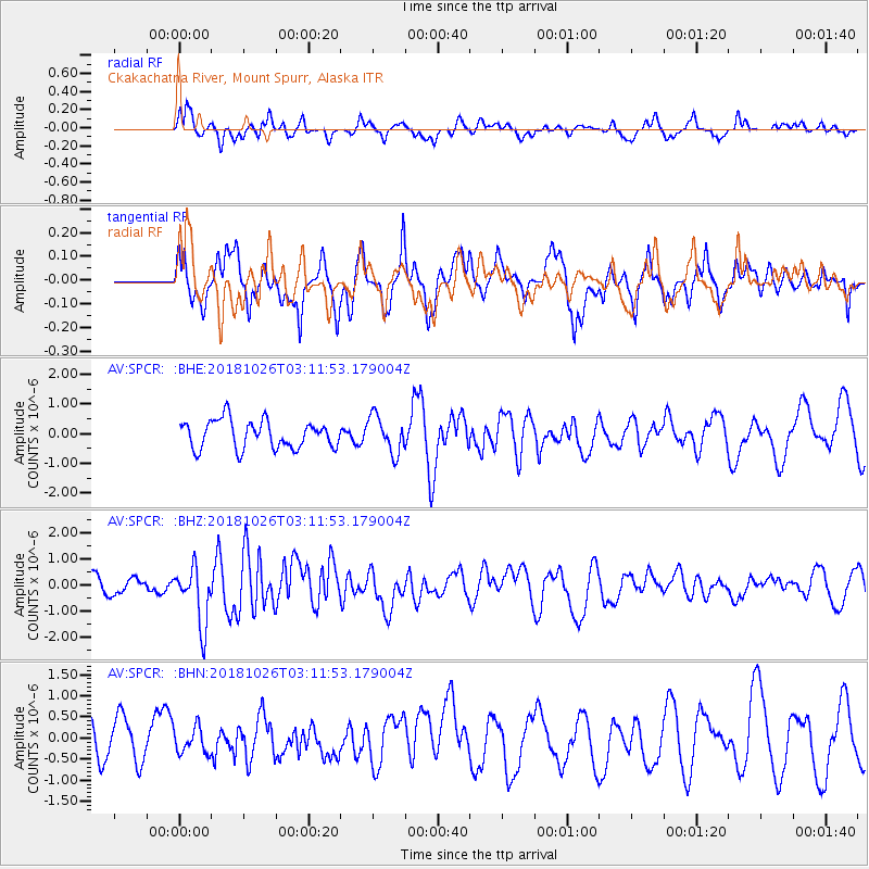
SPCR Ckakachatna River, Mount Spurr, Alaska - Earthquake Result Viewer
*The percent match for this event was below the threshold and hence no stack was calculated.
| Earthquake location: |
Hokkaido, Japan Region |
| Earthquake latitude/longitude: |
44.5/145.4 |
| Earthquake time(UTC): |
2018/10/26 (299) 03:04:53 GMT |
| Earthquake Depth: |
10 km |
| Earthquake Magnitude: |
5.6 Mww |
| Earthquake Catalog/Contributor: |
NEIC PDE/us |
|
| Network: |
AV Alaska Volcano Observatory |
| Station: |
SPCR Ckakachatna River, Mount Spurr, Alaska |
| Lat/Lon: |
61.20 N/152.21 W |
| Elevation: |
984 m |
|
| Distance: |
39.5 deg |
| Az: |
42.466 deg |
| Baz: |
274.376 deg |
| Ray Param: |
$rayparam |
*The percent match for this event was below the threshold and hence was not used in the summary stack. |
|
| Radial Match: |
55.458565 % |
| Radial Bump: |
400 |
| Transverse Match: |
63.80978 % |
| Transverse Bump: |
400 |
| SOD ConfigId: |
13570011 |
| Insert Time: |
2019-05-01 15:02:01.978 +0000 |
| GWidth: |
2.5 |
| Max Bumps: |
400 |
| Tol: |
0.001 |
|
Signal To Noise
| Channel | StoN | STA | LTA |
| AV:SPCR: :BHZ:20181026T03:11:53.179004Z | 3.4208355 | 1.101903E-6 | 3.2211514E-7 |
| AV:SPCR: :BHN:20181026T03:11:53.179004Z | 0.6269265 | 3.0078255E-7 | 4.7977323E-7 |
| AV:SPCR: :BHE:20181026T03:11:53.179004Z | 1.34396 | 6.2640686E-7 | 4.6609037E-7 |
| Arrivals |
| Ps | |
| PpPs | |
| PsPs/PpSs | |


