You are here: Home > Network List > TA - USArray Transportable Network (new EarthScope stations) Stations List
> Station A22K Sinclair Lake, AK, USA > Earthquake Result Viewer
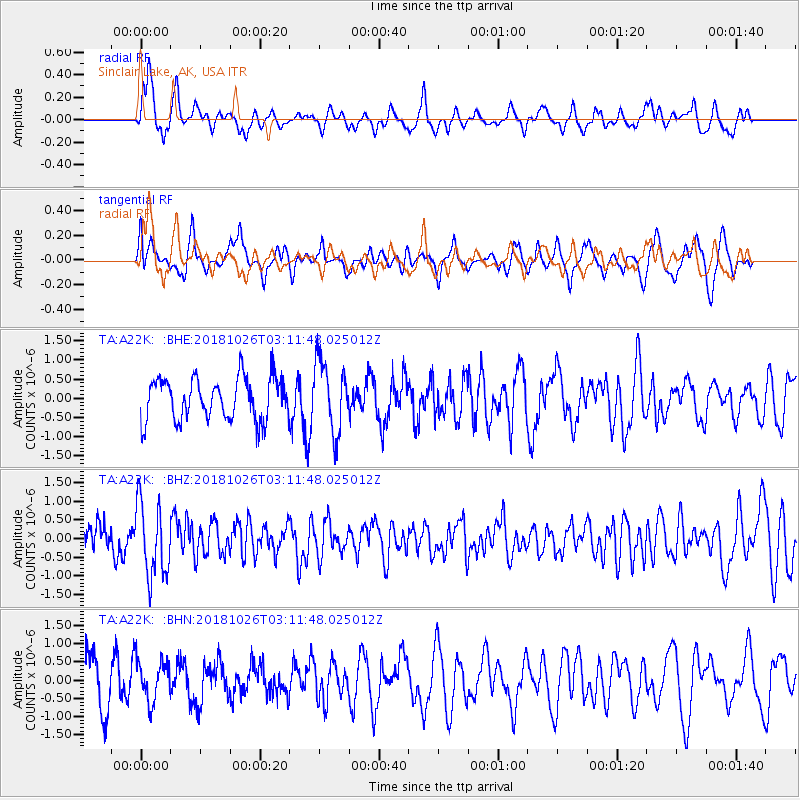
A22K Sinclair Lake, AK, USA - Earthquake Result Viewer
*The percent match for this event was below the threshold and hence no stack was calculated.
| Earthquake location: |
Hokkaido, Japan Region |
| Earthquake latitude/longitude: |
44.5/145.4 |
| Earthquake time(UTC): |
2018/10/26 (299) 03:04:53 GMT |
| Earthquake Depth: |
10 km |
| Earthquake Magnitude: |
5.6 Mww |
| Earthquake Catalog/Contributor: |
NEIC PDE/us |
|
| Network: |
TA USArray Transportable Network (new EarthScope stations) |
| Station: |
A22K Sinclair Lake, AK, USA |
| Lat/Lon: |
71.00 N/154.97 W |
| Elevation: |
6.0 m |
|
| Distance: |
38.8 deg |
| Az: |
26.773 deg |
| Baz: |
259.641 deg |
| Ray Param: |
$rayparam |
*The percent match for this event was below the threshold and hence was not used in the summary stack. |
|
| Radial Match: |
67.65345 % |
| Radial Bump: |
400 |
| Transverse Match: |
61.018707 % |
| Transverse Bump: |
400 |
| SOD ConfigId: |
13570011 |
| Insert Time: |
2019-05-01 15:08:15.962 +0000 |
| GWidth: |
2.5 |
| Max Bumps: |
400 |
| Tol: |
0.001 |
|
Signal To Noise
| Channel | StoN | STA | LTA |
| TA:A22K: :BHZ:20181026T03:11:48.025012Z | 2.2112372 | 9.913971E-7 | 4.48345E-7 |
| TA:A22K: :BHN:20181026T03:11:48.025012Z | 0.9282974 | 5.594759E-7 | 6.026903E-7 |
| TA:A22K: :BHE:20181026T03:11:48.025012Z | 1.6765277 | 9.1710234E-7 | 5.4702485E-7 |
| Arrivals |
| Ps | |
| PpPs | |
| PsPs/PpSs | |


