You are here: Home > Network List > AV - Alaska Volcano Observatory Stations List
> Station AMKA Regional Station, Amchitka Island, Alaska > Earthquake Result Viewer
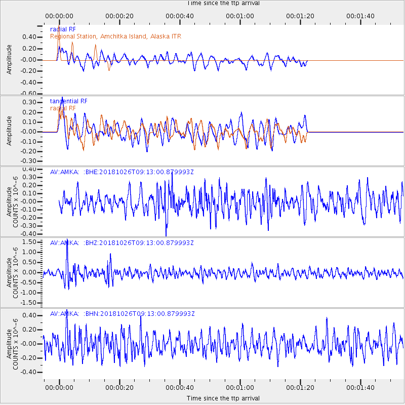
AMKA Regional Station, Amchitka Island, Alaska - Earthquake Result Viewer
*The percent match for this event was below the threshold and hence no stack was calculated.
| Earthquake location: |
Mariana Islands Region |
| Earthquake latitude/longitude: |
17.4/147.9 |
| Earthquake time(UTC): |
2018/10/26 (299) 09:05:39 GMT |
| Earthquake Depth: |
10 km |
| Earthquake Magnitude: |
5.7 mww |
| Earthquake Catalog/Contributor: |
NEIC PDE/us |
|
| Network: |
AV Alaska Volcano Observatory |
| Station: |
AMKA Regional Station, Amchitka Island, Alaska |
| Lat/Lon: |
51.38 N/179.30 E |
| Elevation: |
116 m |
|
| Distance: |
42.1 deg |
| Az: |
29.173 deg |
| Baz: |
227.961 deg |
| Ray Param: |
$rayparam |
*The percent match for this event was below the threshold and hence was not used in the summary stack. |
|
| Radial Match: |
53.906708 % |
| Radial Bump: |
400 |
| Transverse Match: |
63.35146 % |
| Transverse Bump: |
386 |
| SOD ConfigId: |
13570011 |
| Insert Time: |
2019-05-01 15:12:49.610 +0000 |
| GWidth: |
2.5 |
| Max Bumps: |
400 |
| Tol: |
0.001 |
|
Signal To Noise
| Channel | StoN | STA | LTA |
| AV:AMKA: :BHZ:20181026T09:13:00.879993Z | 4.2593 | 5.129176E-7 | 1.2042298E-7 |
| AV:AMKA: :BHN:20181026T09:13:00.879993Z | 1.5825615 | 1.8117363E-7 | 1.1448126E-7 |
| AV:AMKA: :BHE:20181026T09:13:00.879993Z | 1.3258547 | 1.17193196E-7 | 8.839068E-8 |
| Arrivals |
| Ps | |
| PpPs | |
| PsPs/PpSs | |


