You are here: Home > Network List > AV - Alaska Volcano Observatory Stations List
> Station MAPS Pakushin Southeast, Makushin Volcano, Alaska > Earthquake Result Viewer
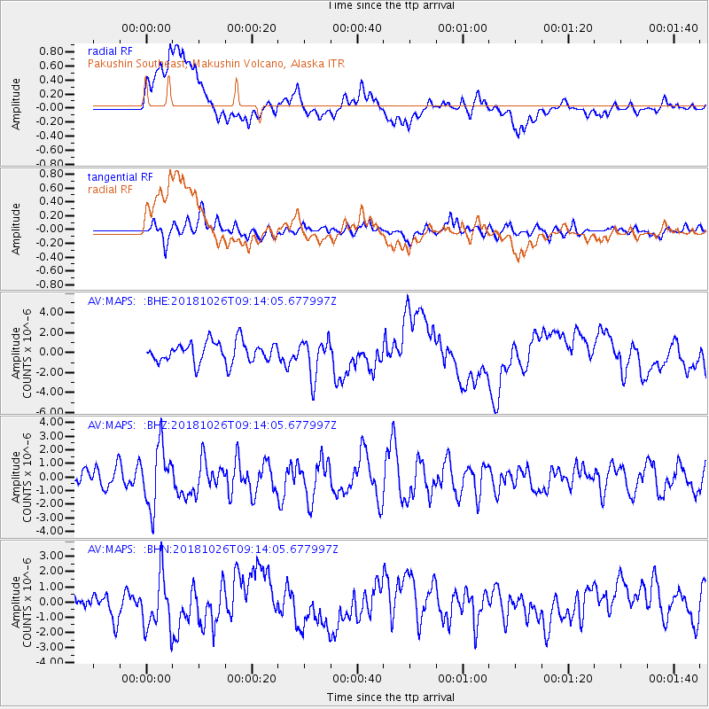
MAPS Pakushin Southeast, Makushin Volcano, Alaska - Earthquake Result Viewer
*The percent match for this event was below the threshold and hence no stack was calculated.
| Earthquake location: |
Mariana Islands Region |
| Earthquake latitude/longitude: |
17.4/147.9 |
| Earthquake time(UTC): |
2018/10/26 (299) 09:05:39 GMT |
| Earthquake Depth: |
10 km |
| Earthquake Magnitude: |
5.7 mww |
| Earthquake Catalog/Contributor: |
NEIC PDE/us |
|
| Network: |
AV Alaska Volcano Observatory |
| Station: |
MAPS Pakushin Southeast, Makushin Volcano, Alaska |
| Lat/Lon: |
53.81 N/166.94 W |
| Elevation: |
333 m |
|
| Distance: |
50.3 deg |
| Az: |
33.124 deg |
| Baz: |
241.626 deg |
| Ray Param: |
$rayparam |
*The percent match for this event was below the threshold and hence was not used in the summary stack. |
|
| Radial Match: |
50.220943 % |
| Radial Bump: |
400 |
| Transverse Match: |
55.470085 % |
| Transverse Bump: |
400 |
| SOD ConfigId: |
13570011 |
| Insert Time: |
2019-05-01 15:12:55.435 +0000 |
| GWidth: |
2.5 |
| Max Bumps: |
400 |
| Tol: |
0.001 |
|
Signal To Noise
| Channel | StoN | STA | LTA |
| AV:MAPS: :BHZ:20181026T09:14:05.677997Z | 2.4362087 | 2.2254117E-6 | 9.1347334E-7 |
| AV:MAPS: :BHN:20181026T09:14:05.677997Z | 2.290199 | 1.8464096E-6 | 8.062224E-7 |
| AV:MAPS: :BHE:20181026T09:14:05.677997Z | 1.829126 | 1.8925435E-6 | 1.034671E-6 |
| Arrivals |
| Ps | |
| PpPs | |
| PsPs/PpSs | |


