You are here: Home > Network List > CI - Caltech Regional Seismic Network Stations List
> Station MPM Manuel Prospect Mine, California, USA > Earthquake Result Viewer
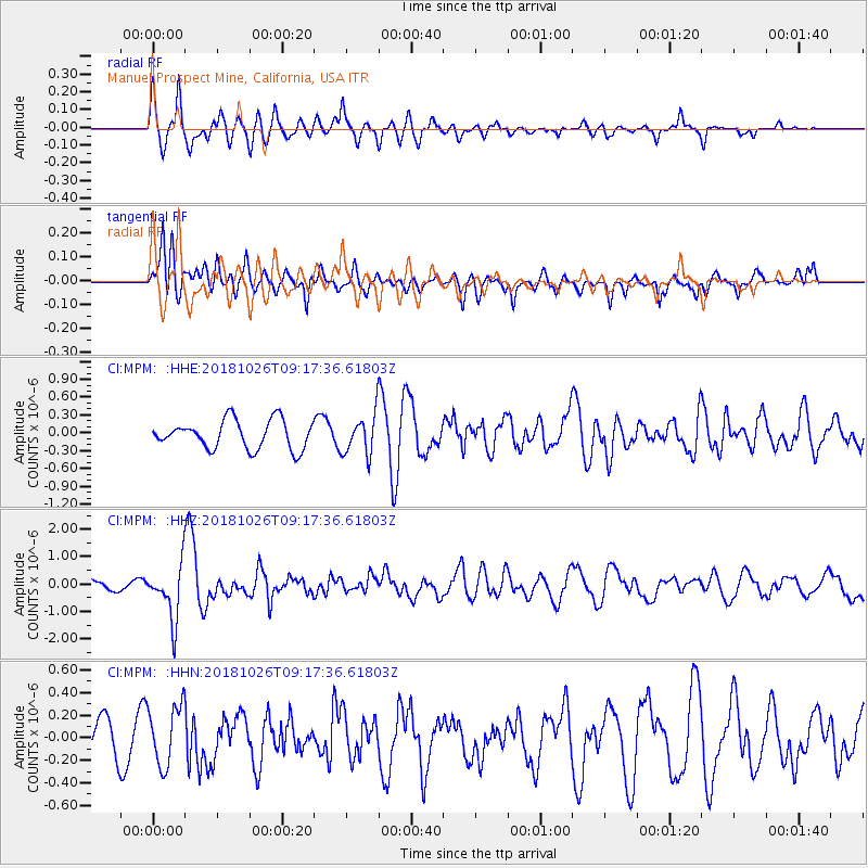
MPM Manuel Prospect Mine, California, USA - Earthquake Result Viewer
*The percent match for this event was below the threshold and hence no stack was calculated.
| Earthquake location: |
Mariana Islands Region |
| Earthquake latitude/longitude: |
17.4/147.9 |
| Earthquake time(UTC): |
2018/10/26 (299) 09:05:39 GMT |
| Earthquake Depth: |
10 km |
| Earthquake Magnitude: |
5.7 mww |
| Earthquake Catalog/Contributor: |
NEIC PDE/us |
|
| Network: |
CI Caltech Regional Seismic Network |
| Station: |
MPM Manuel Prospect Mine, California, USA |
| Lat/Lon: |
36.06 N/117.49 W |
| Elevation: |
185 m |
|
| Distance: |
83.6 deg |
| Az: |
54.362 deg |
| Baz: |
286.711 deg |
| Ray Param: |
$rayparam |
*The percent match for this event was below the threshold and hence was not used in the summary stack. |
|
| Radial Match: |
76.51021 % |
| Radial Bump: |
400 |
| Transverse Match: |
74.6836 % |
| Transverse Bump: |
400 |
| SOD ConfigId: |
13570011 |
| Insert Time: |
2019-05-01 15:14:30.617 +0000 |
| GWidth: |
2.5 |
| Max Bumps: |
400 |
| Tol: |
0.001 |
|
Signal To Noise
| Channel | StoN | STA | LTA |
| CI:MPM: :HHZ:20181026T09:17:36.61803Z | 5.2080593 | 9.935147E-7 | 1.9076487E-7 |
| CI:MPM: :HHN:20181026T09:17:36.61803Z | 1.1799501 | 2.6632804E-7 | 2.2571128E-7 |
| CI:MPM: :HHE:20181026T09:17:36.61803Z | 1.4060175 | 3.3618483E-7 | 2.3910428E-7 |
| Arrivals |
| Ps | |
| PpPs | |
| PsPs/PpSs | |


