You are here: Home > Network List > TA - USArray Transportable Network (new EarthScope stations) Stations List
> Station B18K Kokolik River, AK, USA > Earthquake Result Viewer
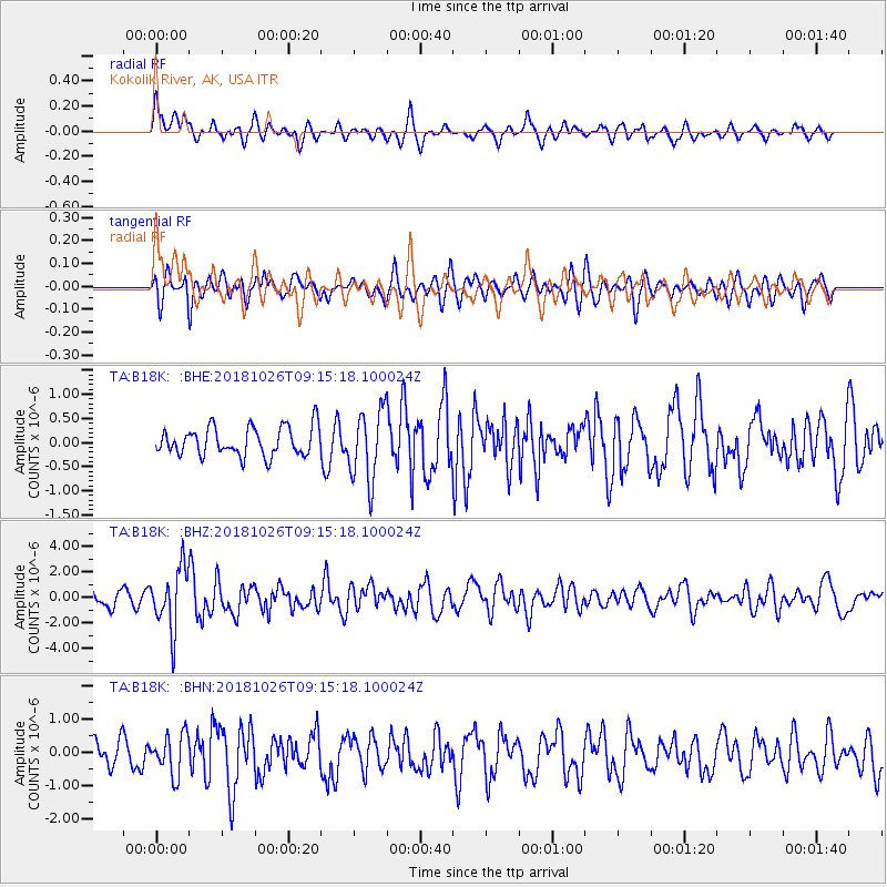
B18K Kokolik River, AK, USA - Earthquake Result Viewer
*The percent match for this event was below the threshold and hence no stack was calculated.
| Earthquake location: |
Mariana Islands Region |
| Earthquake latitude/longitude: |
17.4/147.9 |
| Earthquake time(UTC): |
2018/10/26 (299) 09:05:39 GMT |
| Earthquake Depth: |
10 km |
| Earthquake Magnitude: |
5.7 mww |
| Earthquake Catalog/Contributor: |
NEIC PDE/us |
|
| Network: |
TA USArray Transportable Network (new EarthScope stations) |
| Station: |
B18K Kokolik River, AK, USA |
| Lat/Lon: |
69.36 N/161.80 W |
| Elevation: |
222 m |
|
| Distance: |
60.4 deg |
| Az: |
18.285 deg |
| Baz: |
237.686 deg |
| Ray Param: |
$rayparam |
*The percent match for this event was below the threshold and hence was not used in the summary stack. |
|
| Radial Match: |
72.47828 % |
| Radial Bump: |
400 |
| Transverse Match: |
58.960423 % |
| Transverse Bump: |
400 |
| SOD ConfigId: |
13570011 |
| Insert Time: |
2019-05-01 15:18:18.668 +0000 |
| GWidth: |
2.5 |
| Max Bumps: |
400 |
| Tol: |
0.001 |
|
Signal To Noise
| Channel | StoN | STA | LTA |
| TA:B18K: :BHZ:20181026T09:15:18.100024Z | 3.5111172 | 2.389115E-6 | 6.8044295E-7 |
| TA:B18K: :BHN:20181026T09:15:18.100024Z | 1.5085804 | 6.0584995E-7 | 4.0160268E-7 |
| TA:B18K: :BHE:20181026T09:15:18.100024Z | 2.4825563 | 7.352853E-7 | 2.9618073E-7 |
| Arrivals |
| Ps | |
| PpPs | |
| PsPs/PpSs | |


