You are here: Home > Network List > TA - USArray Transportable Network (new EarthScope stations) Stations List
> Station C16K Lisburne Hills, AK, USA > Earthquake Result Viewer
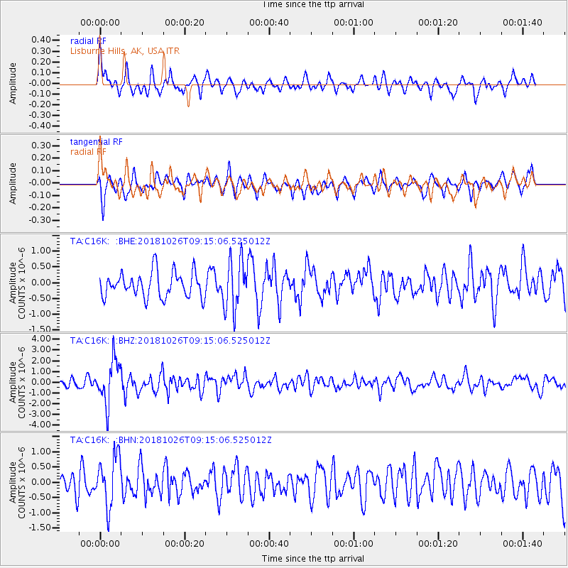
C16K Lisburne Hills, AK, USA - Earthquake Result Viewer
*The percent match for this event was below the threshold and hence no stack was calculated.
| Earthquake location: |
Mariana Islands Region |
| Earthquake latitude/longitude: |
17.4/147.9 |
| Earthquake time(UTC): |
2018/10/26 (299) 09:05:39 GMT |
| Earthquake Depth: |
10 km |
| Earthquake Magnitude: |
5.7 mww |
| Earthquake Catalog/Contributor: |
NEIC PDE/us |
|
| Network: |
TA USArray Transportable Network (new EarthScope stations) |
| Station: |
C16K Lisburne Hills, AK, USA |
| Lat/Lon: |
68.27 N/165.34 W |
| Elevation: |
102 m |
|
| Distance: |
58.7 deg |
| Az: |
18.506 deg |
| Baz: |
234.498 deg |
| Ray Param: |
$rayparam |
*The percent match for this event was below the threshold and hence was not used in the summary stack. |
|
| Radial Match: |
68.03205 % |
| Radial Bump: |
400 |
| Transverse Match: |
62.42334 % |
| Transverse Bump: |
400 |
| SOD ConfigId: |
13570011 |
| Insert Time: |
2019-05-01 15:18:23.521 +0000 |
| GWidth: |
2.5 |
| Max Bumps: |
400 |
| Tol: |
0.001 |
|
Signal To Noise
| Channel | StoN | STA | LTA |
| TA:C16K: :BHZ:20181026T09:15:06.525012Z | 4.5885496 | 2.0384473E-6 | 4.4424655E-7 |
| TA:C16K: :BHN:20181026T09:15:06.525012Z | 2.0886958 | 8.539805E-7 | 4.0885828E-7 |
| TA:C16K: :BHE:20181026T09:15:06.525012Z | 2.0099986 | 7.9538194E-7 | 3.9571268E-7 |
| Arrivals |
| Ps | |
| PpPs | |
| PsPs/PpSs | |


