You are here: Home > Network List > TA - USArray Transportable Network (new EarthScope stations) Stations List
> Station G16K Koyuk River, AK, USA > Earthquake Result Viewer
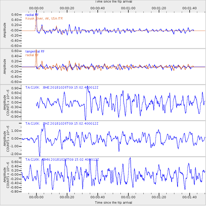
G16K Koyuk River, AK, USA - Earthquake Result Viewer
*The percent match for this event was below the threshold and hence no stack was calculated.
| Earthquake location: |
Mariana Islands Region |
| Earthquake latitude/longitude: |
17.4/147.9 |
| Earthquake time(UTC): |
2018/10/26 (299) 09:05:39 GMT |
| Earthquake Depth: |
10 km |
| Earthquake Magnitude: |
5.7 mww |
| Earthquake Catalog/Contributor: |
NEIC PDE/us |
|
| Network: |
TA USArray Transportable Network (new EarthScope stations) |
| Station: |
G16K Koyuk River, AK, USA |
| Lat/Lon: |
65.39 N/162.35 W |
| Elevation: |
169 m |
|
| Distance: |
58.1 deg |
| Az: |
22.108 deg |
| Baz: |
239.13 deg |
| Ray Param: |
$rayparam |
*The percent match for this event was below the threshold and hence was not used in the summary stack. |
|
| Radial Match: |
76.540764 % |
| Radial Bump: |
400 |
| Transverse Match: |
68.19106 % |
| Transverse Bump: |
400 |
| SOD ConfigId: |
13570011 |
| Insert Time: |
2019-05-01 15:18:59.102 +0000 |
| GWidth: |
2.5 |
| Max Bumps: |
400 |
| Tol: |
0.001 |
|
Signal To Noise
| Channel | StoN | STA | LTA |
| TA:G16K: :BHZ:20181026T09:15:02.400012Z | 6.8231807 | 1.0905177E-6 | 1.5982542E-7 |
| TA:G16K: :BHN:20181026T09:15:02.400012Z | 2.4026825 | 4.3233666E-7 | 1.7993915E-7 |
| TA:G16K: :BHE:20181026T09:15:02.400012Z | 2.7714953 | 6.2569615E-7 | 2.2576121E-7 |
| Arrivals |
| Ps | |
| PpPs | |
| PsPs/PpSs | |


