You are here: Home > Network List > TA - USArray Transportable Network (new EarthScope stations) Stations List
> Station J26L Joseph Creek, AK, USA > Earthquake Result Viewer
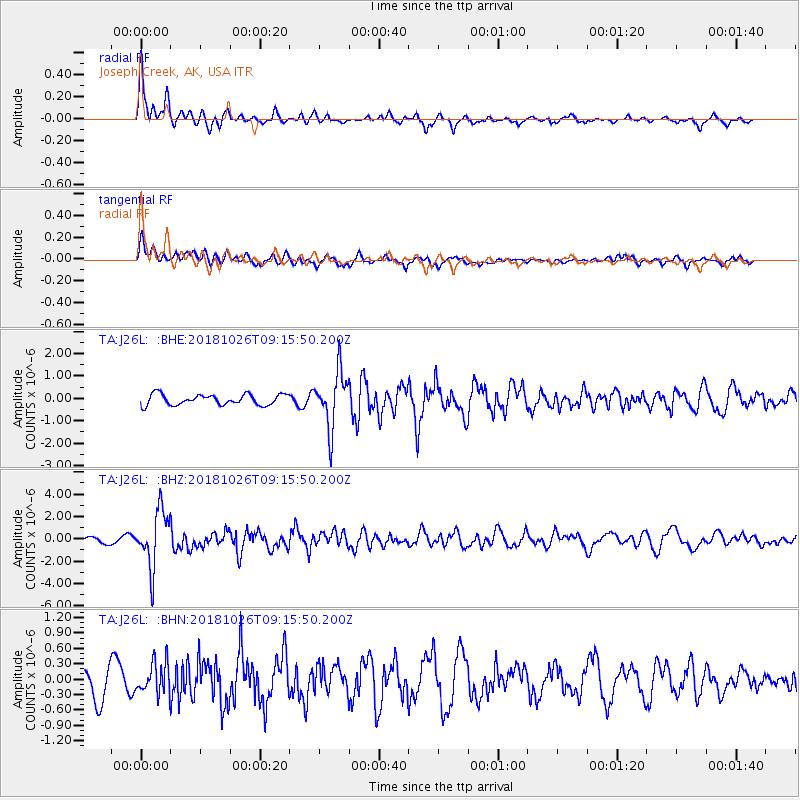
J26L Joseph Creek, AK, USA - Earthquake Result Viewer
*The percent match for this event was below the threshold and hence no stack was calculated.
| Earthquake location: |
Mariana Islands Region |
| Earthquake latitude/longitude: |
17.4/147.9 |
| Earthquake time(UTC): |
2018/10/26 (299) 09:05:39 GMT |
| Earthquake Depth: |
10 km |
| Earthquake Magnitude: |
5.7 mww |
| Earthquake Catalog/Contributor: |
NEIC PDE/us |
|
| Network: |
TA USArray Transportable Network (new EarthScope stations) |
| Station: |
J26L Joseph Creek, AK, USA |
| Lat/Lon: |
64.50 N/143.56 W |
| Elevation: |
1144 m |
|
| Distance: |
65.2 deg |
| Az: |
26.338 deg |
| Baz: |
258.171 deg |
| Ray Param: |
$rayparam |
*The percent match for this event was below the threshold and hence was not used in the summary stack. |
|
| Radial Match: |
77.13501 % |
| Radial Bump: |
393 |
| Transverse Match: |
61.869625 % |
| Transverse Bump: |
400 |
| SOD ConfigId: |
13570011 |
| Insert Time: |
2019-05-01 15:19:30.767 +0000 |
| GWidth: |
2.5 |
| Max Bumps: |
400 |
| Tol: |
0.001 |
|
Signal To Noise
| Channel | StoN | STA | LTA |
| TA:J26L: :BHZ:20181026T09:15:50.200Z | 8.89534 | 2.5008076E-6 | 2.811368E-7 |
| TA:J26L: :BHN:20181026T09:15:50.200Z | 0.8658981 | 3.0332654E-7 | 3.5030283E-7 |
| TA:J26L: :BHE:20181026T09:15:50.200Z | 5.260256 | 1.2402389E-6 | 2.3577542E-7 |
| Arrivals |
| Ps | |
| PpPs | |
| PsPs/PpSs | |


