You are here: Home > Network List > TA - USArray Transportable Network (new EarthScope stations) Stations List
> Station O17K Koliganek, Bristol Bay, AK, USA > Earthquake Result Viewer
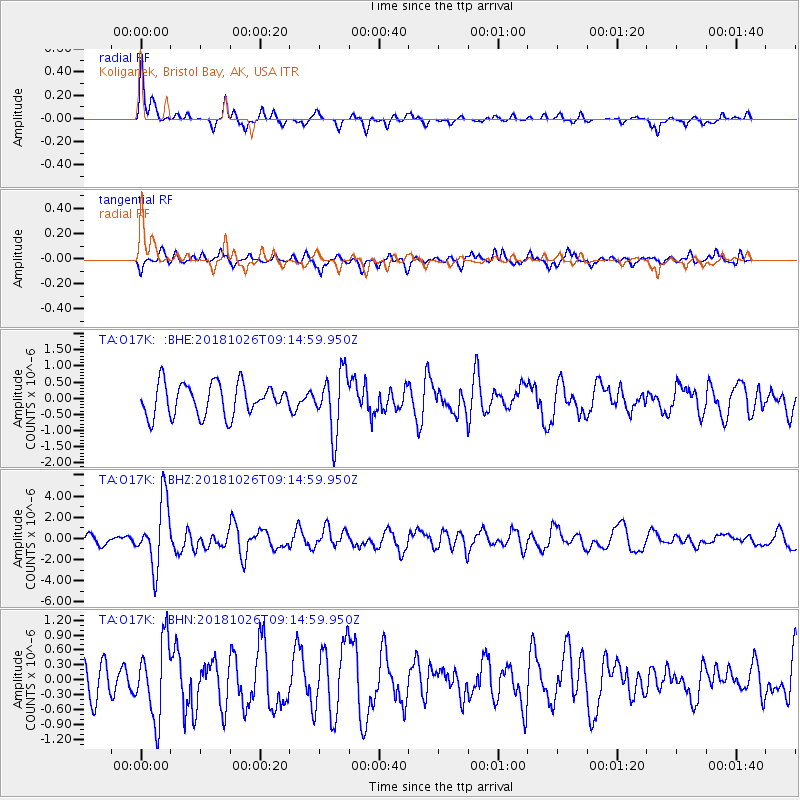
O17K Koliganek, Bristol Bay, AK, USA - Earthquake Result Viewer
*The percent match for this event was below the threshold and hence no stack was calculated.
| Earthquake location: |
Mariana Islands Region |
| Earthquake latitude/longitude: |
17.4/147.9 |
| Earthquake time(UTC): |
2018/10/26 (299) 09:05:39 GMT |
| Earthquake Depth: |
10 km |
| Earthquake Magnitude: |
5.7 mww |
| Earthquake Catalog/Contributor: |
NEIC PDE/us |
|
| Network: |
TA USArray Transportable Network (new EarthScope stations) |
| Station: |
O17K Koliganek, Bristol Bay, AK, USA |
| Lat/Lon: |
59.77 N/157.09 W |
| Elevation: |
156 m |
|
| Distance: |
57.8 deg |
| Az: |
29.34 deg |
| Baz: |
247.639 deg |
| Ray Param: |
$rayparam |
*The percent match for this event was below the threshold and hence was not used in the summary stack. |
|
| Radial Match: |
77.399055 % |
| Radial Bump: |
265 |
| Transverse Match: |
61.262672 % |
| Transverse Bump: |
360 |
| SOD ConfigId: |
13570011 |
| Insert Time: |
2019-05-01 15:20:10.755 +0000 |
| GWidth: |
2.5 |
| Max Bumps: |
400 |
| Tol: |
0.001 |
|
Signal To Noise
| Channel | StoN | STA | LTA |
| TA:O17K: :BHZ:20181026T09:14:59.950Z | 6.017764 | 3.101389E-6 | 5.1537234E-7 |
| TA:O17K: :BHN:20181026T09:14:59.950Z | 2.902469 | 7.6606176E-7 | 2.6393454E-7 |
| TA:O17K: :BHE:20181026T09:14:59.950Z | 1.8691347 | 9.207725E-7 | 4.926197E-7 |
| Arrivals |
| Ps | |
| PpPs | |
| PsPs/PpSs | |


