You are here: Home > Network List > US - United States National Seismic Network Stations List
> Station EGAK Eagle, Central Alaska, Alaska, USA > Earthquake Result Viewer
EGAK Eagle, Central Alaska, Alaska, USA - Earthquake Result Viewer

| Earthquake location: |
Southeast Of Loyalty Islands |
| Earthquake latitude/longitude: |
-22.5/173.1 |
| Earthquake time(UTC): |
2016/08/12 (225) 01:26:35 GMT |
| Earthquake Depth: |
10 km |
| Earthquake Magnitude: |
7.2 MWW, 7.6 MI |
| Earthquake Catalog/Contributor: |
NEIC PDE/NEIC COMCAT |
|
| Network: |
US United States National Seismic Network |
| Station: |
EGAK Eagle, Central Alaska, Alaska, USA |
| Lat/Lon: |
64.78 N/141.16 W |
| Elevation: |
297 m |
|
| Distance: |
93.8 deg |
| Az: |
17.909 deg |
| Baz: |
221.584 deg |
| Ray Param: |
0.041179337 |
| Estimated Moho Depth: |
35.0 km |
| Estimated Crust Vp/Vs: |
1.93 |
| Assumed Crust Vp: |
6.566 km/s |
| Estimated Crust Vs: |
3.407 km/s |
| Estimated Crust Poisson's Ratio: |
0.32 |
|
| Radial Match: |
92.65283 % |
| Radial Bump: |
400 |
| Transverse Match: |
81.6074 % |
| Transverse Bump: |
400 |
| SOD ConfigId: |
1634031 |
| Insert Time: |
2016-08-26 01:29:17.072 +0000 |
| GWidth: |
2.5 |
| Max Bumps: |
400 |
| Tol: |
0.001 |
|
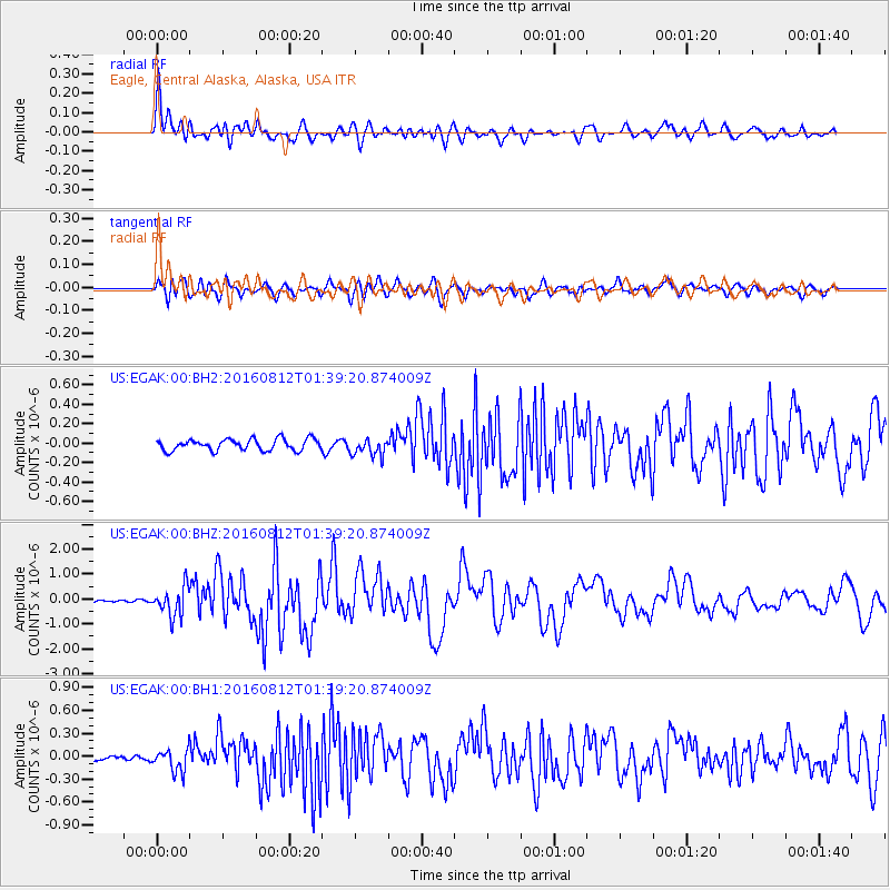
Signal To Noise
| Channel | StoN | STA | LTA |
| US:EGAK:00:BHZ:20160812T01:39:20.874009Z | 10.529216 | 5.820271E-7 | 5.5277347E-8 |
| US:EGAK:00:BH1:20160812T01:39:20.874009Z | 3.746114 | 1.4885428E-7 | 3.9735653E-8 |
| US:EGAK:00:BH2:20160812T01:39:20.874009Z | 1.5576048 | 9.075455E-8 | 5.8265453E-8 |
| Arrivals |
| Ps | 5.0 SECOND |
| PpPs | 15 SECOND |
| PsPs/PpSs | 20 SECOND |


