You are here: Home > Network List > TS - TERRAscope (Southern California Seismic Network) Stations List
> Station BAR Barrett Dam, California, USA > Earthquake Result Viewer
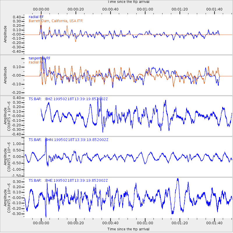
BAR Barrett Dam, California, USA - Earthquake Result Viewer
*The percent match for this event was below the threshold and hence no stack was calculated.
| Earthquake location: |
Sea Of Okhotsk |
| Earthquake latitude/longitude: |
46.7/145.9 |
| Earthquake time(UTC): |
1995/02/18 (049) 13:29:06 GMT |
| Earthquake Depth: |
355 km |
| Earthquake Magnitude: |
5.6 MB, 5.7 UNKNOWN, 5.5 MW |
| Earthquake Catalog/Contributor: |
WHDF/NEIC |
|
| Network: |
TS TERRAscope (Southern California Seismic Network) |
| Station: |
BAR Barrett Dam, California, USA |
| Lat/Lon: |
32.68 N/116.67 W |
| Elevation: |
548 m |
|
| Distance: |
71.7 deg |
| Az: |
61.757 deg |
| Baz: |
313.996 deg |
| Ray Param: |
$rayparam |
*The percent match for this event was below the threshold and hence was not used in the summary stack. |
|
| Radial Match: |
54.973446 % |
| Radial Bump: |
400 |
| Transverse Match: |
53.444805 % |
| Transverse Bump: |
400 |
| SOD ConfigId: |
4480 |
| Insert Time: |
2010-02-26 13:59:40.309 +0000 |
| GWidth: |
2.5 |
| Max Bumps: |
400 |
| Tol: |
0.001 |
|
Signal To Noise
| Channel | StoN | STA | LTA |
| TS:BAR: :BHN:19950218T13:39:19.852002Z | 2.8332667 | 4.6740328E-7 | 1.6496973E-7 |
| TS:BAR: :BHE:19950218T13:39:19.852002Z | 1.2533439 | 1.214728E-7 | 9.691896E-8 |
| TS:BAR: :BHZ:19950218T13:39:19.852002Z | 1.8998607 | 1.830025E-7 | 9.6324165E-8 |
| Arrivals |
| Ps | |
| PpPs | |
| PsPs/PpSs | |


