You are here: Home > Network List > TA - USArray Transportable Network (new EarthScope stations) Stations List
> Station E18K Tukpahlearik Creek, AK, USA > Earthquake Result Viewer
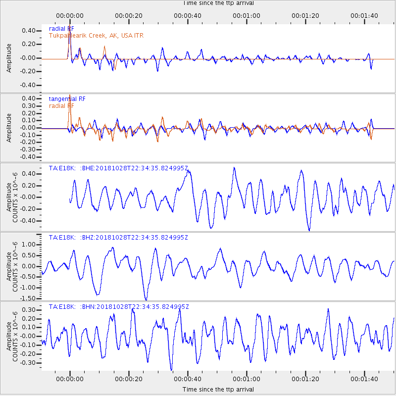
E18K Tukpahlearik Creek, AK, USA - Earthquake Result Viewer
*The percent match for this event was below the threshold and hence no stack was calculated.
| Earthquake location: |
Off Coast Of Central America |
| Earthquake latitude/longitude: |
12.9/-90.4 |
| Earthquake time(UTC): |
2018/10/28 (301) 22:23:54 GMT |
| Earthquake Depth: |
25 km |
| Earthquake Magnitude: |
6.1 Mww |
| Earthquake Catalog/Contributor: |
NEIC PDE/us |
|
| Network: |
TA USArray Transportable Network (new EarthScope stations) |
| Station: |
E18K Tukpahlearik Creek, AK, USA |
| Lat/Lon: |
67.42 N/160.60 W |
| Elevation: |
297 m |
|
| Distance: |
70.6 deg |
| Az: |
337.336 deg |
| Baz: |
103.39 deg |
| Ray Param: |
$rayparam |
*The percent match for this event was below the threshold and hence was not used in the summary stack. |
|
| Radial Match: |
74.45046 % |
| Radial Bump: |
400 |
| Transverse Match: |
66.369446 % |
| Transverse Bump: |
400 |
| SOD ConfigId: |
13570011 |
| Insert Time: |
2019-05-01 15:57:28.857 +0000 |
| GWidth: |
2.5 |
| Max Bumps: |
400 |
| Tol: |
0.001 |
|
Signal To Noise
| Channel | StoN | STA | LTA |
| TA:E18K: :BHZ:20181028T22:34:35.824995Z | 3.4155366 | 4.3254568E-7 | 1.2664061E-7 |
| TA:E18K: :BHN:20181028T22:34:35.824995Z | 1.0471892 | 1.1479586E-7 | 1.09622846E-7 |
| TA:E18K: :BHE:20181028T22:34:35.824995Z | 0.9075012 | 1.2700684E-7 | 1.3995225E-7 |
| Arrivals |
| Ps | |
| PpPs | |
| PsPs/PpSs | |


