You are here: Home > Network List > TA - USArray Transportable Network (new EarthScope stations) Stations List
> Station L15K Ungalak Mountain, AK, USA > Earthquake Result Viewer
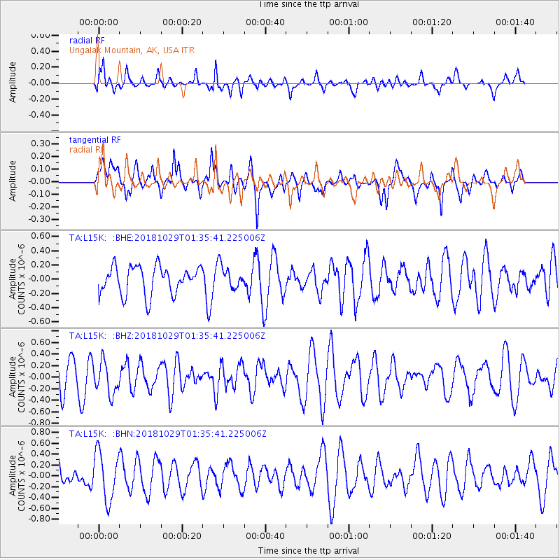
L15K Ungalak Mountain, AK, USA - Earthquake Result Viewer
*The percent match for this event was below the threshold and hence no stack was calculated.
| Earthquake location: |
Southeast Of Honshu, Japan |
| Earthquake latitude/longitude: |
31.6/140.2 |
| Earthquake time(UTC): |
2018/10/29 (302) 01:27:44 GMT |
| Earthquake Depth: |
94 km |
| Earthquake Magnitude: |
5.5 Mww |
| Earthquake Catalog/Contributor: |
NEIC PDE/us |
|
| Network: |
TA USArray Transportable Network (new EarthScope stations) |
| Station: |
L15K Ungalak Mountain, AK, USA |
| Lat/Lon: |
61.68 N/161.49 W |
| Elevation: |
219 m |
|
| Distance: |
47.8 deg |
| Az: |
33.222 deg |
| Baz: |
258.645 deg |
| Ray Param: |
$rayparam |
*The percent match for this event was below the threshold and hence was not used in the summary stack. |
|
| Radial Match: |
65.60677 % |
| Radial Bump: |
400 |
| Transverse Match: |
66.79567 % |
| Transverse Bump: |
400 |
| SOD ConfigId: |
13570011 |
| Insert Time: |
2019-05-01 16:06:07.280 +0000 |
| GWidth: |
2.5 |
| Max Bumps: |
400 |
| Tol: |
0.001 |
|
Signal To Noise
| Channel | StoN | STA | LTA |
| TA:L15K: :BHZ:20181029T01:35:41.225006Z | 1.1127067 | 2.8472604E-7 | 2.55886E-7 |
| TA:L15K: :BHN:20181029T01:35:41.225006Z | 2.0015872 | 4.590336E-7 | 2.2933482E-7 |
| TA:L15K: :BHE:20181029T01:35:41.225006Z | 0.6512546 | 1.2753303E-7 | 1.9582669E-7 |
| Arrivals |
| Ps | |
| PpPs | |
| PsPs/PpSs | |


