You are here: Home > Network List > TJ - Tajikistan National Seismic Network Stations List
> Station GARM Garm, Tajikistan > Earthquake Result Viewer
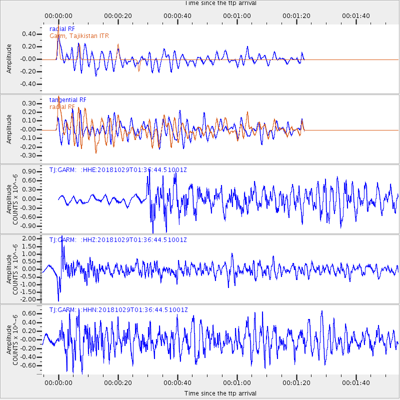
GARM Garm, Tajikistan - Earthquake Result Viewer
*The percent match for this event was below the threshold and hence no stack was calculated.
| Earthquake location: |
Southeast Of Honshu, Japan |
| Earthquake latitude/longitude: |
31.6/140.2 |
| Earthquake time(UTC): |
2018/10/29 (302) 01:27:44 GMT |
| Earthquake Depth: |
94 km |
| Earthquake Magnitude: |
5.5 Mww |
| Earthquake Catalog/Contributor: |
NEIC PDE/us |
|
| Network: |
TJ Tajikistan National Seismic Network |
| Station: |
GARM Garm, Tajikistan |
| Lat/Lon: |
39.00 N/70.32 E |
| Elevation: |
1305 m |
|
| Distance: |
56.3 deg |
| Az: |
298.382 deg |
| Baz: |
74.485 deg |
| Ray Param: |
$rayparam |
*The percent match for this event was below the threshold and hence was not used in the summary stack. |
|
| Radial Match: |
66.00775 % |
| Radial Bump: |
400 |
| Transverse Match: |
63.563843 % |
| Transverse Bump: |
400 |
| SOD ConfigId: |
13570011 |
| Insert Time: |
2019-05-01 16:06:36.170 +0000 |
| GWidth: |
2.5 |
| Max Bumps: |
400 |
| Tol: |
0.001 |
|
Signal To Noise
| Channel | StoN | STA | LTA |
| TJ:GARM: :HHZ:20181029T01:36:44.51001Z | 8.479419 | 8.543648E-7 | 1.0075748E-7 |
| TJ:GARM: :HHN:20181029T01:36:44.51001Z | 2.1632986 | 2.6316047E-7 | 1.2164777E-7 |
| TJ:GARM: :HHE:20181029T01:36:44.51001Z | 4.733218 | 4.399209E-7 | 9.2943296E-8 |
| Arrivals |
| Ps | |
| PpPs | |
| PsPs/PpSs | |


