You are here: Home > Network List > TS - TERRAscope (Southern California Seismic Network) Stations List
> Station BAR Barrett Dam, California, USA > Earthquake Result Viewer
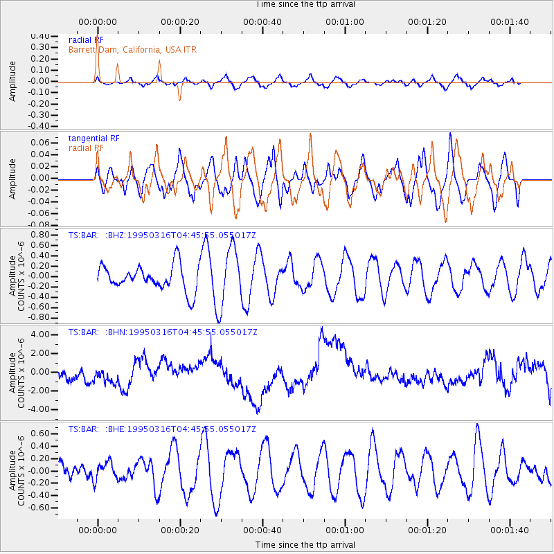
BAR Barrett Dam, California, USA - Earthquake Result Viewer
*The percent match for this event was below the threshold and hence no stack was calculated.
| Earthquake location: |
Fiji Islands Region |
| Earthquake latitude/longitude: |
-21.6/-176.5 |
| Earthquake time(UTC): |
1995/03/16 (075) 04:34:44 GMT |
| Earthquake Depth: |
182 km |
| Earthquake Magnitude: |
5.5 MB, 5.4 UNKNOWN, 5.7 MW |
| Earthquake Catalog/Contributor: |
WHDF/NEIC |
|
| Network: |
TS TERRAscope (Southern California Seismic Network) |
| Station: |
BAR Barrett Dam, California, USA |
| Lat/Lon: |
32.68 N/116.67 W |
| Elevation: |
548 m |
|
| Distance: |
78.6 deg |
| Az: |
48.052 deg |
| Baz: |
235.143 deg |
| Ray Param: |
$rayparam |
*The percent match for this event was below the threshold and hence was not used in the summary stack. |
|
| Radial Match: |
55.101173 % |
| Radial Bump: |
400 |
| Transverse Match: |
51.931786 % |
| Transverse Bump: |
400 |
| SOD ConfigId: |
4480 |
| Insert Time: |
2010-02-26 13:59:43.167 +0000 |
| GWidth: |
2.5 |
| Max Bumps: |
400 |
| Tol: |
0.001 |
|
Signal To Noise
| Channel | StoN | STA | LTA |
| TS:BAR: :BHN:19950316T04:45:55.055017Z | 1.1261706 | 7.776167E-7 | 6.904964E-7 |
| TS:BAR: :BHE:19950316T04:45:55.055017Z | 0.5563247 | 1.4823652E-7 | 2.6645682E-7 |
| TS:BAR: :BHZ:19950316T04:45:55.055017Z | 2.3634946 | 5.7425007E-7 | 2.4296654E-7 |
| Arrivals |
| Ps | |
| PpPs | |
| PsPs/PpSs | |


