You are here: Home > Network List > TA - USArray Transportable Network (new EarthScope stations) Stations List
> Station X21A Alamocita Creek, Datil, NM, USA > Earthquake Result Viewer
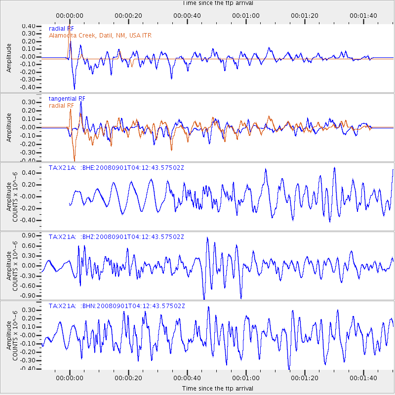
X21A Alamocita Creek, Datil, NM, USA - Earthquake Result Viewer
*The percent match for this event was below the threshold and hence no stack was calculated.
| Earthquake location: |
South Of Fiji Islands |
| Earthquake latitude/longitude: |
-25.4/-177.6 |
| Earthquake time(UTC): |
2008/09/01 (245) 04:00:39 GMT |
| Earthquake Depth: |
171 km |
| Earthquake Magnitude: |
5.7 MB, 6.0 MW, 6.0 MW |
| Earthquake Catalog/Contributor: |
WHDF/NEIC |
|
| Network: |
TA USArray Transportable Network (new EarthScope stations) |
| Station: |
X21A Alamocita Creek, Datil, NM, USA |
| Lat/Lon: |
34.45 N/107.79 W |
| Elevation: |
2141 m |
|
| Distance: |
89.0 deg |
| Az: |
50.893 deg |
| Baz: |
238.137 deg |
| Ray Param: |
$rayparam |
*The percent match for this event was below the threshold and hence was not used in the summary stack. |
|
| Radial Match: |
74.42993 % |
| Radial Bump: |
400 |
| Transverse Match: |
58.99567 % |
| Transverse Bump: |
361 |
| SOD ConfigId: |
2504 |
| Insert Time: |
2010-03-06 17:18:53.559 +0000 |
| GWidth: |
2.5 |
| Max Bumps: |
400 |
| Tol: |
0.001 |
|
Signal To Noise
| Channel | StoN | STA | LTA |
| TA:X21A: :BHZ:20080901T04:12:43.57502Z | 2.5582232 | 2.6728736E-7 | 1.0448164E-7 |
| TA:X21A: :BHN:20080901T04:12:43.57502Z | 1.1308707 | 1.1053743E-7 | 9.774542E-8 |
| TA:X21A: :BHE:20080901T04:12:43.57502Z | 1.2214816 | 1.646182E-7 | 1.3476928E-7 |
| Arrivals |
| Ps | |
| PpPs | |
| PsPs/PpSs | |


