You are here: Home > Network List > CI - Caltech Regional Seismic Network Stations List
> Station MPM Manuel Prospect Mine, California, USA > Earthquake Result Viewer
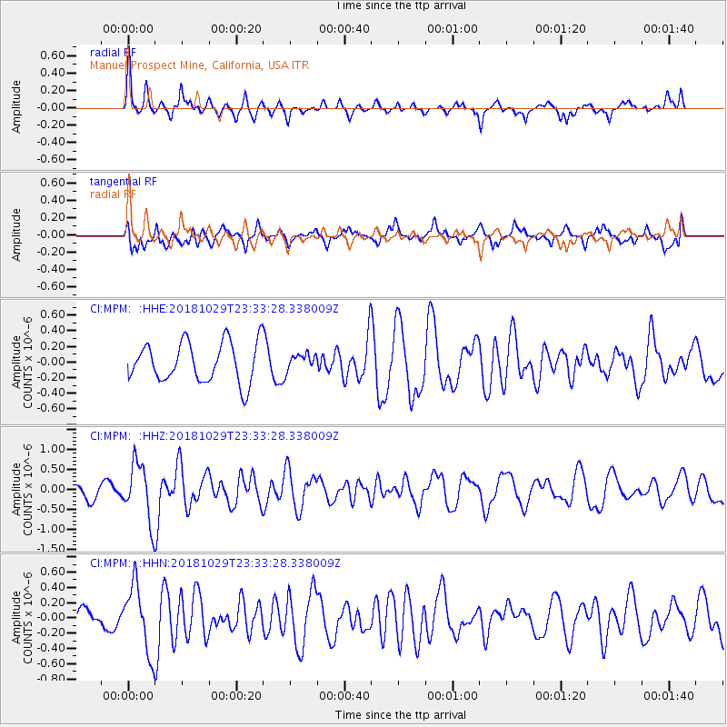
MPM Manuel Prospect Mine, California, USA - Earthquake Result Viewer
*The percent match for this event was below the threshold and hence no stack was calculated.
| Earthquake location: |
Central East Pacific Rise |
| Earthquake latitude/longitude: |
-4.6/-105.9 |
| Earthquake time(UTC): |
2018/10/29 (302) 23:26:09 GMT |
| Earthquake Depth: |
10 km |
| Earthquake Magnitude: |
5.8 Mww |
| Earthquake Catalog/Contributor: |
NEIC PDE/us |
|
| Network: |
CI Caltech Regional Seismic Network |
| Station: |
MPM Manuel Prospect Mine, California, USA |
| Lat/Lon: |
36.06 N/117.49 W |
| Elevation: |
185 m |
|
| Distance: |
41.8 deg |
| Az: |
345.89 deg |
| Baz: |
162.548 deg |
| Ray Param: |
$rayparam |
*The percent match for this event was below the threshold and hence was not used in the summary stack. |
|
| Radial Match: |
73.23447 % |
| Radial Bump: |
400 |
| Transverse Match: |
68.05549 % |
| Transverse Bump: |
400 |
| SOD ConfigId: |
13570011 |
| Insert Time: |
2019-05-01 16:28:39.407 +0000 |
| GWidth: |
2.5 |
| Max Bumps: |
400 |
| Tol: |
0.001 |
|
Signal To Noise
| Channel | StoN | STA | LTA |
| CI:MPM: :HHZ:20181029T23:33:28.338009Z | 5.734305 | 7.2654757E-7 | 1.2670195E-7 |
| CI:MPM: :HHN:20181029T23:33:28.338009Z | 5.2351623 | 4.413901E-7 | 8.4312596E-8 |
| CI:MPM: :HHE:20181029T23:33:28.338009Z | 0.4055978 | 1.0299483E-7 | 2.539334E-7 |
| Arrivals |
| Ps | |
| PpPs | |
| PsPs/PpSs | |


