You are here: Home > Network List > TA - USArray Transportable Network (new EarthScope stations) Stations List
> Station I23K Minto, Yukon-Koyukuk, AK, USA > Earthquake Result Viewer
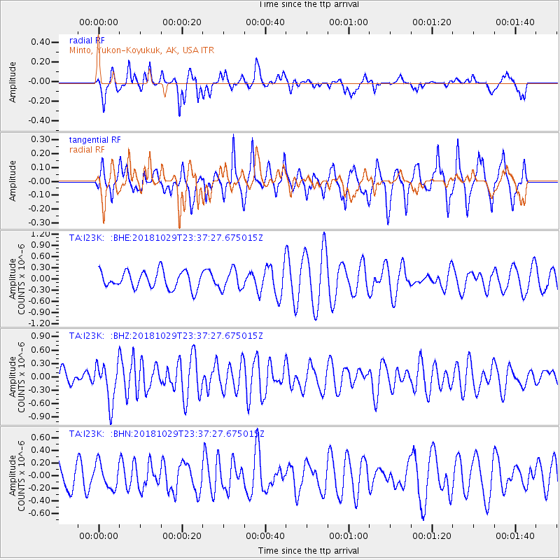
I23K Minto, Yukon-Koyukuk, AK, USA - Earthquake Result Viewer
*The percent match for this event was below the threshold and hence no stack was calculated.
| Earthquake location: |
Central East Pacific Rise |
| Earthquake latitude/longitude: |
-4.6/-105.9 |
| Earthquake time(UTC): |
2018/10/29 (302) 23:26:09 GMT |
| Earthquake Depth: |
10 km |
| Earthquake Magnitude: |
5.8 Mww |
| Earthquake Catalog/Contributor: |
NEIC PDE/us |
|
| Network: |
TA USArray Transportable Network (new EarthScope stations) |
| Station: |
I23K Minto, Yukon-Koyukuk, AK, USA |
| Lat/Lon: |
65.15 N/149.36 W |
| Elevation: |
149 m |
|
| Distance: |
76.5 deg |
| Az: |
342.606 deg |
| Baz: |
135.158 deg |
| Ray Param: |
$rayparam |
*The percent match for this event was below the threshold and hence was not used in the summary stack. |
|
| Radial Match: |
59.738216 % |
| Radial Bump: |
331 |
| Transverse Match: |
62.637367 % |
| Transverse Bump: |
361 |
| SOD ConfigId: |
13570011 |
| Insert Time: |
2019-05-01 16:34:08.907 +0000 |
| GWidth: |
2.5 |
| Max Bumps: |
400 |
| Tol: |
0.001 |
|
Signal To Noise
| Channel | StoN | STA | LTA |
| TA:I23K: :BHZ:20181029T23:37:27.675015Z | 1.9180595 | 4.4471648E-7 | 2.318575E-7 |
| TA:I23K: :BHN:20181029T23:37:27.675015Z | 0.7242574 | 2.0273652E-7 | 2.7992328E-7 |
| TA:I23K: :BHE:20181029T23:37:27.675015Z | 1.1584357 | 2.6339248E-7 | 2.2736909E-7 |
| Arrivals |
| Ps | |
| PpPs | |
| PsPs/PpSs | |


